Quantcast
Channel: Urbsite
Viewing all 197 articles
Browse latest View live

FINISHING THE MILE OF HISTORY

$
0
0
The development of a 'Mile of History' on Sussex Drive was the primary action item listed in the conclusions of the National Capital Commisson's landmark study of 1961. The mile turned out be a rocky road. Troubled by false starts, Government cancellations, fires and demolitions that were chasing ahead of the NCC's plans. One could say that while it has been underway for more than 50 years it's still work in progress. (Drawing: The 'after' picture, Sussex decked out in her Confederation-era dress - Preserving Our Heritage, NCC April 1961)
The Mile of Living History was 'given the official promise of realization with cabinet approval' on August 10, 1961, just four months after the release of the NCC's 'Preserving Our Heritage' report regarding the acquisition and restoration of historic buildings in the National Capital Region. An $8 million package of property purchases and construction costs, it had been elevated to the status of the Government of Canada's official Centennial Project for the City of Ottawa. (Ottawa Journal, August 10, 1961)
By the end of 1961 the City of Ottawa) or at least Mayor Charlotte Whiten) had become an enthusiastic support. She charged that “fly-by-night companies” were trying to capitalize and the Federal Government’s plans for Sussex. She said that it was “deplorable… scandalous… unpatriotic that two or three avaricious people are speculating in land”, and urged the City to endorse a companion project in the Byward Market by approving a temporary zoning by-law that would freeze development in this part of Lowertown. ‘The city hopes to “preserve, reconstruct, and renovate” the market area in an extension of the Mile of History project.’ The Mayor’s efforts were ultimately stymied by the Dalhousie District Businessmen’s Association and the Ward’s two Aldermen. (Ottawa Journal, December 5, 1961) 
Visited by successive fires, historic facades hidden under plain fronts, and dominated by mostly gritty businesses, the Sussex Street of 1959, as photographed from the roof of the Connaught Building, gave little hint of its role as Ottawa one of most important commercial thoroughfares. (Photo: LAC, Ted Grant Collection)
The clutter of Sussex Street's signage, fire escapes, and overhead wiring were particular bugbears to the NCC which labeled them as tatty, downmarket - a degradation of the historic buildings' dignity. The photo is also a reminder that Sussex was just half a street thanks to the Borden Government's cancellation of the defeated Laurier Government's 1906-07 grand plan for the Exchequer Court complex which had swept away all of the buildings on the west side.
In 1963 Sussex was the scene of another political axe-wielding when ex-P.M. Diefenbaker’s pet projects (like the Mile of History') were nixed by the newly-elected Liberal Government . ’For Centennial - No Plans To Dress Up Sussex - 'Any “mile of history” on Sussex Drive in conjunction with the 1967 centennial “would be a mile of future history,” Privy Council President Lamontagne said at the closing press conference on the National Conference on the Centennial, when asked about the development of Sussex. “If there was to be a mile of history erected there,” he replied, “it would be a mile of future history, since we have demolished most of the historic buildings along there.” He added that no plans were being entertained to do anything else to Sussex.’ (Ottawa Journal, October 17, 1963)
After more than a year in office the Pearson Government remained firm. ’Mile Of History Stalled - 'Federal plans for restoration of two historic areas of Ottawa have been consigned to limbo. State Secretary Lamontagne said that development of both the Mile of History on Sussex Drive and the pioneer settlement on Richmond Landing is being delayed. They had been conceived and pushed by former Prime Minister Diefenbaker as part of Ottawa’s centennial planning. ‘ Lamontagne added that no detailed plans had been worked out because the NCC had to devote its time and money to other projects of higher priority. Buildings on Sussex would have their outsides painted and cleaned, but no structural changes would be made. The ‘pioneer settlement’ and park at Richmond’s Landing would have to wait until the future development of Lebreton Flats. (Ottawa Journal, June 4, 1964) 
Sneaking ahead to the final outcome of this story - all of the offending elements had been successfully expunged by the early 1970s. Of interest is the three-story brick structure with a tiny mansard roof and narrow window openings, the first new building to be constructed after the Mile of History was underway, replacing the Jules Patry wholesale warehouse that had left Sussex for the City Centre in 1963. Designed by Rosen, Caruso, Vecsei Architects of Montreal, it was an early effort at historicized modernism which has since been more heavily historicized with a more quaintly ornamented storefront.
Back to the beginning - in conjunction with the NCC's Advisory Committee on History in 1960 the restoration architect Peter John Stokes was retained. Through his elegant restorations at Niagara-on-the-Lake Stokes had established a reputation for historic sensitivity. He was asked to prepare specifications for the restoration of Sussex Street which 'when restored would have all the exterior finish completed in immaculate detail, to resemble the Confederation period. Store signs, windows, doors and awnings would be made to conform to those which were known to have previously existed.' The buildings X'ed out in this street elevation actually refer to later events in another block. (Preserving Our Heritage, NCC 1961) 
The concept for a Mile of History was in large part sparked by the destruction of this handsome stone building at Sussex and Bruyere Streets, Thomas Goulden's Hotel (1852-1860). Judged to be one of the finest buildings on the street, its demolition was opposed by the Ottawa Historical Society which appealed to the City of Ottawa to save it, and a personal intervention by Prime Minister John Diefenbaker. It was a great loss but it provided the impetus for some form of government action on the Mile of History. (Photo: LAC-e010934805)
Despite these protests, in December 1959 the fight was lost and the demolition proceeded the following summer for a gas station. Nonetheless it had a galvanic effect on the NCC, which had just been given the mandate to administer the conservation and restoration of historic buildings. (Photo: City Archives AN-004606)
Shortly after the ambitious report had been adopted and approved by the Government of Canada and just before the NCC could move to expropriate the buildings, one of Sussex's key blocks was significantly diminished when the Hotel du Canada and the Bishop's Block at the corner of St.Patrick Street were heavily damaged by a fire, and were taken down. (Photo: Michael Newton, Lower Town Ottawa, NCC 1980)
On the other end of the block at Murray Street the Laurendau Block-Valin Apartments met a similar fate, in the same year. By the time that the NCC acquired it the building was a burned shell, and their first action was to demolish it. (Photo: Michael Newton, Lower Town Ottawa, NCC 1980)
This was the St. Patrick-Murray Street block in its entirety although it was misidentified as Murray-to-Clarence in the 1961 report. Cost-recovery for the purchase and restoration would be amortized through office space rentals 'within a surprisingly short period'. It noted that 'Areas in other cities that have been preserved in this fashion have become a mecca for discriminating tenants, and it is not unrealistic to suggest that space in this area might become among the most sought after in Ottawa.' That prophesy has not come to pass, and during the ensuing decades commercial tenanting has been problematic.
Despite the availability of Peter Stokes' drawings and historic photographs, the NCC has not rebuilt the missing ends of the St. Patrick-Murray block, although it has never been hesitant about improving on history. (Photo: Michael Newton, Lower Town Ottawa, NCC 1980)
Five of the buildings on Sussex Drive are now facsimile reproductions of the original ones. This is a practice perfected by the NCC for reasons of efficiency and marketability, a technique that is not entirely embraced by the heritage industry.
Does Facadism always equal Disneyfication? It's the least best option for historic building restoration, but it's too late to ask. The National Capital Commission was proud of its work. (Photo: NCC Annual Reports)
In the four blocks beyond St. Patrick Street (top half of the 1961 report's drawing above) given the presence of three major institutional buildings there was no need to demolish and recreate  - with the Notre Dame Church, Academy de la Salle, and the Grey Nuns/Sisters of Charity Convent in safe hands.  This left only the Bruyere-to-St. Andrew section of Sussex, the site of Goulden's Hotel, to be dealt with. Which the NCC did with some enthusiasm, as it soon expropriated the gas station property, demolished the building, and built a small parking lot buffered by landscaping. In Peter John Stokes' concept plan this block was suggested for a new office building.
News of the Government of Canada's surprise announcement to expropriate the northern half of Sussex from Cathcart to King Edward was buried by their decision one month later (April 12, 1962) to seize five times as much land on Lebreton Flats. The Sussex expropriation of 32 acres containing 400 households came as 'a bit of a bombshell' during Ontario Municipal Board Hearings into a new medical-dental building proposed for the area. The NCC plan would ease all trace of Mactaggart, Redpath, and Baird Streets, and the former CPR railway yards. This tract of land was to be used for a variety of purposes, including new government buildings, the approaches to the proposed Macdonald Cartier Bridge, redevelopment of the 'Mile of History' running from St. Patrick Street to City Hall, and a further addition to the Rideau River shoreline park. (Ottawa Journal, March 14, 1962)
It was unclear how an extended Mile of History could possibly fit into the plans for a new roadway and government buildings, which required the removal of vast amounts of earth to create the interchange between Sussex and the Macdonald Cartier Bridge. (Ottawa Journal, August 24, 1963)
After all of the historic buildings north of Boteler Street had been cleared away the Mile of History was effectively terminated at the bend in Sussex Drive. (GeoOttawa, 1965)
Any possibility that the Mile of History that might have lead to the gates of Rideau Hall was permanently halted by this beast, the Lester B. Pearson Building, headquarters of the then Department of External Affairs (Webb Zerafa Menkes and Housden Architects, 1969). The architects defended their design as being extremely sensitive to its setting, but the External Affairs building was excoriated for being a hostile bunker. While it's mellowed somewhat with age it's hard to believe that its designers had ever visited the site. (Photos: Ottawa Journal, April 28, 1973, OFART-Old Foreign Affairs Retired Technicians)
By 1965 the Pearson Government's hardened stance on Sussex Drive had softened, a little. In his article ‘Old Street With a New Face’, architect Stig Harvor of Balharrie Helmer Associates summed up the change of heart. ’The austerity program of 1963 shelved plans of converting the building interiors into rentable, modern office space. The only work undertaken to date has been the exterior facelift. But what a visual change this facelift has produced! The buildings have regained, and one suspects, often surpassed, their old charm. They now form the only comprehensive attempt in Ottawa - and perhaps in Canada - to create a ‘streetscape’ where building materials, facades, colors, store fronts and signs are looked upon as a total composition rather than a composite of unrelated parts. We have the example of Sussex Drive as a dramatic illustration of the big effects which can be achieved with small means. Under the expert architectural eye eye of John Leaning, the National Capital Commission has spent about $80,000 to give Sussex Drive a colourful new appearance. - ‘Old Street With a New Face’ by Stig Harvor, Ottawa Journal, May 28, 1965. For about 1% of its original estimated cost the NCC had given the street a cheap and cheerful makeover. (Photo: NCC Annual Report, 1968)
By the early 1970s the Mile of History project was in the ascendancy at the NCC. Work was hastened when one of the commercial buildings between George and York was destroyed by fire. The hole needed to be filled and while they were at it, the little building next door containing the Rose Cafe and La Hacienda could be improved upon.  (Photo: City Archives)
It provided the first opportunity to put the NCC's new approach demolishing the existing buildings they deemed to be too 'structurally unsound', build facsimile historic facades attached to modern buildings that would serve another purpose - in this case commercial units at grade and loft apartments above.  They would go on to do this to the Castor Hotel, and the Hotel du Canada/Laurendau Block.
Sometimes the buildings could be returned to a more 'appropriate' period. The 1870s facade of the Riel-McDougal blocks had been altered in the early 1900s by a fourth floor addition. (Photo: NCC Annual Report, 1974)
When it came time to rehabilitate the building for flats and new stores the top floor was removed and replaced by a highly conjectural attic story. A hybrid of this methodology was followed in the next block for the adaptive re-use of the Institut Jeanne d'Arc. (Photo: NCC Annual Report, 1980)
This philosophy has been the driving principle to architectural restoration on Sussex Drive since 1961:  'Sussex Street, restored to Confederation days, building facades renovated, advertising signs removed, sidewalk widened, trees planted, building signs lettered in period script.'
The Mile of History was not universally endorsed. At the Ontario Association of Architects’ supper discussion meeting with the theme “What Purpose the Centennial?” OAA Secretary Mike Kohler ‘expressed discontent with the Federal Government’s plan to turn Sussex Drive into a Mile of Living History’ and told the gathering that he would prefer to see a national theatre or auditorium built in Ottawa for the occasion ‘since the architecture to be restored on Sussex Drive is not especially attractive.’ (Ottawa Journal, November 21, 1961) 
The stone buildings at 541 Sussex Drive were to be the flagship restoration project for the Mile of History. The Ottawa Journal announced the plans on September 16, 1961: ‘Once a fashionable hotel, this building, stripped of its verandahs and with a new roof, still stands on the northeast corner of Sussex Drive and George Street. Today it is used as RCAF Headquarters Dental Clinic. In the year of Confederation, it housed British soldiers here as a guard for the Governor General. Built in 1827 as a tavern, it had a series of names until, in 1875 it became the Clarendon Hotel. In 1880 the Canadian Government acquired the building for the newly formed Geological Survey of Canada, and it was thus employed until recently. Soon it will be restored to its 1867 appearance under the NCC’s “Mile of History” project.’ To this list you could add that it was the scene for the first Royal Canadian Academy exhibition of March 1880, the beginnings of the National Gallery of Canada. (Canadian Illustrated News, 1880) 
Of course its 1867 appearance could not be a target date for restoration, because through its multitude of uses and transformations the building had been rebuilt several times. The history of this building is so complex that it requires a 50-page chronology in Michael Newton's Lower Town Ottawa - Vol 2, NCC 1980- Vol 2, NCC 1980. Michael was an National Capital Commission's in-house historian employed to do the kind of pure research that no federal agency would pay for today. (Photo: LAC a008438)
541 Sussex had been condemned and promised a new life once before, although nothing more came from these plans. ’FOR USE AS A MUSEUM - 'The old Custom House at Sussex and George will not now go under the wrecker’s hammer, Works Minister Winters announced Thursday [December 15, 1955]. Instead it will be turned over to the Historic Sites and Monuments Board for use as a museum.’ (Photo: JRAIC, 1955)
While it was initially the first priority restoration of the building was deferred for decades and it had make do with one of the NCC's interim inexpensive fix-ups, painting stripes on the blind attic story. (Photo: NCC Library)
Its many chimneys are still missing, but a standing seam metal roof, eaves with brackets, and an eyebrow dormer window have finally been returned to the former GGFG Militia Barracks, British/Clarendon Hotel, Geological Survey of Canada, Department of Mines, RCAF Dental Clinic, etc.
Peter Stokes' 1961 plan included an early concept for a chain of landscaped courtyards and parking areas behind the Sussex Street buildings, starting on George Street at the right and flowing through the Murray on the left.
The NCC acquired additional properties at the rear to accomplish this. (Photo: NCC Library)
They were used as surface parking for many years. To hide the lot the National Capital Commission built a stone screening wall with two arched openings along George Street in 1965. I can recall Rolf Latte, the Commission's sharp-tongued Information and Heritage Officer crowing that when the City of Ottawa first established its Heritage Buildings Reference List in 1979 they had been fooled by the NCC's new wall and included it in their list of historic structures.
The wall had to come down for the Clarendon Court.
Through fits and starts the Mile of History has reflected the rise and fall of the National Capital Commission's budgets and political influence. Lauding the plans for the Mile of History in its editorial of June 19, 1961 the Ottawa Journal had said 'It is satisfying the learn that a detailed study has been prepared for part of the street between the Basilica and York Street showing how buildings may be restored, "woven into the historic fabric", to use the NCC's good phrase. ...These plans must not be considered as merely visionary and impractical. The NCC keeps its mind on the main task in bringing forward new ideas. We need more, not fewer plans. We need daring and imaginative concepts which will make Ottawa a city of culture, a place which nourishes humane values, as well as a city of expressways and open spaces.'

HOW NANNY GOAT HILL ALMOST GOT RENEWED

$
0
0
During the 1960s large tracts of Lowertown, Preston Street, and all of Lebreton Flats were eradicated in the zeal for urban renewal. A little-known project for the Nanny Goat Hill district was also planned, but never implemented. Fuelled by generous CMHC subsidies and the promise of full federal cost-sharing, in 1959-61 the City of Ottawa conducted intensive urban renewal studies in over twenty selected neighbourhoods to determine which areas suffered from the worst forms of ‘urban blight’ and ranked them for future urban renewal projects. When districts were determined to be overcrowded, unsanitary, and the existing housing found to be sufficiently blighted (which generally just meant old) they were prime candidates for a total razing and replacement. 
Over its 11-acre site the Nanny Goat Hill area accommodated 159 dwelling units housing 638 people - the lowest population densities of any of the urban renewal areas being studied for action. Only 26% of the housing stock was judged to be ‘seriously substandard’ - a very small proportion of ‘poor to very poor’ dwellings needed to achieve an urban renewal target. However, because Nanny Goat Hill contained the smallest percentage of ‘good’ dwellings, in the planners’ minds this apparent obstacle to complete sectoral demolition was ignored and total redevelopment was required. This decision was reinforced by ‘overcrowding’ in the poor residences (5.8 persons per unit) and a ‘lack of adequate sanitation and household facilities’
A fully modernized Nanny Goat Hill area as it might have appeared in 1967 or so. Because the site was isolated from the rest of the Dalhousie neighbourhood, making it difficult for children to access schools and recreation facilities, it was recommend that the new development be focused on just two population groups  - a senior citizens’ complex (at  the left) and apartment buildings for singles and couples without children (on the right). Empress and Perkins would have been closed to create plazas, and the steep hill would be landscaped backdrop to the project.
Although it ranked fairly high in terms of the planners’ scoring system for urban blight, the urban renewal of Nanny Goat Hill was deferred because of the uncertainty of the Federal Government’s plans for Lebreton Flats.
The Nanny Goat Hill Area Study drew a boundary around the triangle of land below the hill, which would have included all of the houses along the east side of Lorne Avenue, and both sides of Perkins, and Empress.  On the map the slope of Nanny Goat Hill itself was labeled ‘LIMESTONE BLUFF - NOT USABLE’. 
The aerial photo shows this district as it appeared in the early 1960s after the construction of the Good Companions Seniors’ Centre (the hatched area on the map), which was to escape expropriation, but would have become the centrepiece of a proposed new seniors’ residential  compound in a park-like setting.
This sketch published in the Ottawa Journal on October 21, 1963 illustrated an overview of  Ottawa’s city-wide urban renewal scheme - “These are the areas that planners would like to clean up with judicious use of senior government funds available for urban renewal action. By areas, they are: 1, Mechanicsville; 2, Hintonburgh; 3, Nanny Goat Hill; 4, Preston Street; 5, Nepean Street; 6, Deep Cut; 7, Lower Town; 8, Hurdman Bridge.” Of this list, only the Lowertown and Preston Street area would receive urban renewal action. 
The Good Companions of Ottawa, a social service centre for seniors, was founded by the Anglican Diocese in 1955, and first met in St. George’s Church Hall. In 1959 they moved into their new quarters at 670 Albert Street, designed by architects Noffke and Ingram on land donated by Mr. Harold Vail.
The populace of Nanny Goat Hill was not surveyed for its opinions. As was the case in most of the City’s urban renewal planning areas municipal officials were encouraged by the fact that a relatively high percentage of renters versus owners would make it easier, and cheaper, to displace the in situ residents. In the end the only residents displaced where those living in houses demolished for the Good Companions' ever-expanding parking lots.

There is something very chilling about the cold dispatch with which the authors of urban renewal used their scientific methodology to condemn established communities. Compare the plans in the lower left (buildings existing in 1961) and the upper right (the area after it had been ‘cleaned up’). The multiplicity of small buildings would have been swept away, replaced by large towers, and the small streets closed and converted into superblocks. The planners conceded that the Nanny Goat Hill area was an isolated pocket stranded between its eponymous cliff and the megadevelopments to come of the Flats, so they hoped to create an insulated pedestrian core shielded from areas of intense activity.

A previous version of this posting was published as a 'Dalhoustory' in the August 21st edition of the Centretown BUZZ.

THE JACKSON BUILDING'S MANY LIVES

$
0
0
The story of the Jackson Building is both fabled and fraught. Its history has been buffeted by great events - both World Wars, a man-made disaster, the Roaring Twenties, the birth of Canada's radio broadcasting, and the vagaries of Federal Government accommodation. The Jackson has now slipped back into obscurity. Hard to believe that what is today an anonymous brick block was once one of Ottawa’s best-known addresses. And, that there are still a few stories to be told. This post is replete with lengthy extracts from the overheated advertising copy-writers of the 1920s and 30s, which will have to suffice until photographs of the Jackson's more exciting features are uncovered.
The Jackson Building (1919-20) was designed by J. Albert Ewart in a restrained Tudor-Jacobean style. Ewart had just completed the Transportation Building (1916) for Booth, and later designed Gordon Edward's Victoria Building on Wellington Street (1928) in a similar vein. (Photo: Plan for the National Capital General Report, 1949)
As it grew grimy with age, and the rooftop features became unstable and had to be removed, the Jackson Building entered a long slow decline. (Photo: CA 023178)
In 1969-71 the Jackson was modernized with a total makeover designed by James Strutt. 
The Jackson' history began with Jackson Booth’s aborted 1912 purchase of the Bank Street Presbyterian Church at Bank and Slater, which was notable for its tall stone spire The church was built in 1866, and remodelled after a fire in 1881 by William Hodgson. The transaction was halted when it was discovered the church’s founding charter required the congregation to sell their property through a competitive process. A second sale was duly arranged, but fell through because of bidding irregularities. Booth was successful on the third round.  In August 1913 Jackson Booth was ready to reveal that he would build a new ‘Amusement Resort’ costing $170,000, splendidly fitted with one of the finest organs that can be procured. The four story arcade building would contain a theatre ‘with seating capacity of twenty-two to twenty-four thousand [sic?] to be used for showing high class picture plays and stage productions. The architectural design and decorations will be plain and neat, Mr. Booth obtaining this idea from his visits to New York.’ For a variety of reasons, the intervention of WWI, and Jackson Booth’s concentration on other money-making office rental properties like the Transportation Building on Rideau Street and the Standard Bank Building on Sparks Street, the grandiose entertainment palace was shelved. However, the notion of a spectacular place for public merriment would be resurrected when the Jackson Building was finally built. 
The 1920 sub-headline sums up the ‘Completion of Jackson Block an Epoch in Local Building. War interfered with the start of the work which however was completed in 18 months. New structure is handsome and commodious one of stores and offices with all most modern appliances in lighting, heating, elevators, etc. Partitions are interchangeable. Modern roof garden is beautifully equipped.’ The Ottawa Citizen described the atmospheric effects of that modern roof garden, the Century Roof - ‘The roof garden attracts the attention of even the pedestrian by day or night. In the day time flowers,  plants and hanging gardens are easily visible and at night the numerous and brilliant electric lights cannot be overlooked, but provide a conspicuous landmark for miles around. Festoons of small electric bulbs, a dozen large single lamps and half a dozen cluster lights contribute to a dazzling illumination scheme and present a singularly fascinating and alluring scene.' (Photo: Ottawa Citizen, October 20, 1920)
The roof of the Jackson Building is empty in this shot from the top of the Hunter Building taken in 1938, but for a few brief years at the beginning of the 1920s it was a hot spot. ’Surmounting the ninth floor is the pent house for the elevator shafts. This is artistically worked into the design of the building. The roof garden itself is a sight worth the trip in the elevator to see. It is bordered with flower boxes containing all manner of flowering plants, while here and there in huge tubs are trees and shrubbery. At the west end, a raised platform with concave roof and back is provided for an orchestra, ensuring that the sound of the music is carried to all parts of the roof. On the south side a raised terrace extends the full length of the roof, and here the merrymakers halt for refreshments. From all the tables an unobstructed view of the dancers on the main floor can be obtained. The place is brilliant with clusters and row upon row of smaller lights.’ (Photo: NCC Library Ottawa Buildings)
'A feature, not only of the Jackson Building, nor of Ottawa alone, but of the whole wide Dominion of Canada is the magnificent CENTURY ROOF. Very fitting is that on the most modern and stately building of Canada's City Beautiful, reposes a Beauty Spot of refined beauty and amusement. There it is that the elite of the Capital, the dance-lovers, the people who know where comfort is to be found, congregate for their evening recreation. A glistening floor set in a veritable flower-garden, with an incomparable Novelty Jazz Orchestra, is what awaits you on the Century Roof, where there is ever a breeze a-stirring, where heat is an unknown visitor. That, then, is the story of the jewelled crown of the Jackson Building...'
The Jackson’s 200 office suites were modern in every way, suitable for the display of the latest in technology, like the Burroughs Mechanical Book-Keeping system. ’The second to seventh floors are divided into office spaces, ..everyone of which has direct outside lighting. The partitions are of the interchangeable unit type which have already been used to advantage in the various Booth buildings in Ottawa for the past seven years. The great advantage of these partitions is that when necessary an entire floor can be opened throughout, without destroying the material in the partitions. Changes of occupants often make it necessary to re-arrange the interior, and with ordinary partitions this means tearing down walls and building hew ones. The interchangeable unit partition is easily taken out, involves no dirt, and requires but a few hours’ time.’ 
The broad windows on the second floor afforded additional retail rental opportunities. Many shops liked to feature drawings of the Jackson in their advertising and for a time it was sufficiently famous to become a 'logo-quality' building. (Ottawa Journal, March 1922)
’The eighth floor is entirely used for a modern dancing assembly hall, known as the “Rose Room". It is conducted as a winter adjunct to the “Century Roof” which occupies the top of the building.’ (Ottawa Journal, October 1, 1920) The Jackson’s eighth floor dance hall could accommodate 700 or more, and the roof gardens another 800. At least one of the Jackson’s six elevators was always set aside as an express cab to the Rose Room, and after business hours all of them were in continuous operation to bring the crowds to the top of the building.
’The Century Roof was opened to the public on May 24, 1920 as a roof garden and since then, when the weather was conducive, proved a popular spot with the young people of the city. It was also a mecca for thousands of visitors, who beside enjoying the cooling breezes, used the roof as a sight-seeing point. A magnificent view in all directions is attainable.’
The Rose Room, ‘winter adjunct to the Century Roof’ deserves some mention. 'The Rose Room gives the impression of beauty without gaudiness. The walls are tastefully decorated, while the lace and art curtains surrounding the windows harmonize with the rest of the decoration. The lamps are delicately shaded in pink, and the soft light which pervades the entire room justifies the name which the hall bears. The dancing floor is highly polished and is laid on wooden springs which add an elasticity to the dancers’ steps, helping the pleasure by obviating the possibility of fatigue. A neatly furnished ladies’ rest room completes the equipment of the “Rose Room”.’
For business reasons, and a more profitable rental from another equally exciting use, the Century Roof was closed after 1922. The Rose Room continued for another year, when the space was divided into classrooms and leased to the Ottawa Collegiate Board for the High School of Commerce. Its name continued on in the Jackson Building as the Rose Room Beauty Parlour on the fifth floor. In 1924 another Rose Room dance hall opened in the Arcade Building on Sparks Street, but didn’t last long.
The 1920s were the Jackson’s Golden Age, when it was indeed a hive of industry. After the Metropolitan Life Insurance Company of Canada decided to build its national head office in Ottawa they leased several floors here while their new headquarters on Wellington Street was being built. Until it relocated to Montreal the Canadian National Railway had its first head office in the Jackson Building. 
It was here that the CNR built one its first radio stations, call letters CNRO for Canadian National Railway Ottawa, which first started broadcasting on February 27, 1924. This is the operating room, full of electronic gear. The CNRO studios were located on the ground floor. Broadcasts from off-site venues in Ottawa were transmitted to the Jackson Building via the telephone wires.(Photo: CMST - CN Collection)
Once the fancy trappings of the Century Roof were cleared away, two masts for the radio station’s transmission towers were anchored at opposite corners of the Jackson Building roof. In contemporary accounts the towers were described as 75 to 90 height, giving an elevation off the street of 185 to 265 feet. In 1927 CNRO left the Jackson and moved to the top floor of the Chateau Laurier. (Photo: Radio Magazine March 1925)
After its Jazz Age excitement in the first half of the 1920s the Jackson Building began to lose some of its lustre and because of its dated style could no longer be considered Ottawa's most prestigious office building. Through the 1930s there were few changes, apart from various tenants rotating through the ground floor. (Photo: LAC e10934920)
This street view is placed here just for a then-and-now comparison of the corner of Bank and Slater - except to say that at only nine stories the Jackson Building continued to tower over its surroundings until the late 1960s.
’Duncan Allen (‘Dunc’) had already established two successful downtown lunchrooms when he opened the flagship Allen’s Lunch on the ground floor of the Jackson on June 18, 1934. His full-page ad painted a vivid word picture of the interior - ‘Decorated in pale buff and cream, with modern mono-metal fittings…. At the Bank street entrance the soda fountain,..almost impossible to believe that it is of all-steel construction and so beautiful with its Circassian walnut finish. The counter and front are resplendent in dark green and cream marble. In the restaurant itself .the tables are of chrome metal, which gives the appearance of lightness with unusual strength, the tops being finished with formica. The chairs are also of chrome metal but the upholstery is of washable rubberoid, apple green in color, with a watered silk finish. These fixtures were prize winners at the Chicago World’s Fair [1933’s ‘Century of Progress’] and reflect great credit on their Canadian manufacturers.’
Allen's Lunch seems to have co-existed with William R. Low who located his spacious drug store and a particularly smart luncheon and soda counter here on April 30, 1935 - although they both couldn't have simultaneously occupied the entire ground floor of the Jackson Building. Low was displaced when the Bell Telephone Company of Canada took over his building at Slater and O'Connor for their new art deco building.
Comparing these two photos of the Jackson's lower floors it's evident in the intervening 30 years (1938 and 1968) that something has happened to the building. At some point the Jackson Building's Slater Street elevation was lengthened from 9 bays to 12.
The contrast is clearly seen on the upper floors as well. The reason - World War II and its impact on the City of Ottawa transformed the Jackson Building.
To accommodate exponential growth in the civil service and military personnel brought on by WWII in 1941 the Government of Canada launched an unprecedented building boom that would leave a mark on the city for many years. 'The greater part of the construction is of a temporary nature and is to come down some time after the war.  Some permanent structures have been erected. Other buildings have been purchased which are due for demolition in keeping with plans for a more beautiful Ottawa, but they were purchased for the use of war departments.' By 1943 the costs had reached over $10 million, which didn't include necessary repairs, smaller projects, or the rental of space in almost a hundred buildings scattered across the city. (Ottawa Citizen, March 26, 1943)
The Government of Canada purchased the Jackson Building from C.J. Booth in 1941 for $650.000. Sitting tenants (including the offices of the building’s architect J. Albert Ewart) were given just two weeks to vacate and the Jackson was soon handed over to the staff of the Royal Canadian Air Force. It was insufficient to meet the needs of the RCAF, and an addition was required. The new Jackson Annex was a part of the 1941 Temporary Buildings programme, although unlike the temps it was expected to last after the War. At a cost of $381,820 the Jackson was considerably more expensive than the temporaries - $6.50 a square foot versus $3.00 for the typical temporary. From clearing the adjacent houses on Slater to occupancy construction took one full year, while a temporary could be put up in 60-70 days. (Photo: LAC)
The Jackson Building Annex was freestanding, not structurally attached to the older building, although exterior walls were built only on the three exposed sides. Internal connections on each floor were made by openings in the west wall of the old Jackson Building. The Annex had its own entrance and elevators, but from the 1948 fire insurance plate, it seems to have shared the boilers .
Demolition of the houses on Slater Street was underway in September 1941. It's curious that the Government took so little property for the Annex, which added less than 25% more floor space. (Photo: LAC)
Blasting and excavation commenced in early October 1942, tight against the Sula Apartments on Slater Street (Photo: LAC).
Within two weeks the foundation walls were going in. The timbered truck ramp indicates that construction access was from the north side of the property, using the rear Albert Street buildings. (Photo: LAC)
As of November 4, 1941 the basement had been poured and the hole was being filled in by the ground floor slab and supporting columns. From these photos the structural frame appears to have been reinforced concrete, although events in one of the Jackson's Building's later chapters suggested otherwise. (Photo: LAC)
The Jackson Building was three and a half floors out of the ground by December 20, 1941.  At this blistering pace the Jackson Annex was finished and occupied by late summer 1942. What is equally remarkable is that despite being constructed during the wartime emergency, the DPW architects didn't erect a plain utilitarian building but took the time and effort to match the addition to the old building with identical arcaded windows, streaky bacon-striped masonry trim and the notched rooftop parapet wall. (Photo: LAC)
The Jackson covered in scaffolding in the mid-1950s, likely for the removal of the corner towers and parapet wall along the roof. Down the street were the bright lights of the Odeon Theatre's marquee. The theatre would soon be joined with the Jackson Building in an event that rocked the city.
One of the worst disasters to visit Ottawa occurred right across the street from the Jackson Building early in the morning of Saturday, October 25, 1958 when an undetected gas leak in the Addressograph-Multigraph Company was ignited by the janitor of the Odeon as he flicked on the theatre's lights. The Slater Street buildings were reduced to splinters and the adjoining auditorium of the Odeon blown open. The janitor was killed immediately, the only death resulting from the explosion.
The one stroke of luck is that it 'could have been a slaughter'. In a few hours the theatre would have been packed full for the children's matinee, and had it happened on a busy weekday the injuries to pedestrians in the street incurred by shards of glass and debris flying at supersonic speed would have been monstrous. (Ottawa Journal, October 25, 1958)
Although it was still standing the impact on the interior of the Jackson Building was tremendous. The pressure wave from the explosion was so powerful that elevator doors were ripped off on each floor. (Ottawa Journal, October 27, 1958)
All of the windows of the Jackson were blown inward with a violent force that the scattered the contents of the offices into blizzards of paper. Had it happened on a work day there certainly would have been scores of grievous injuries and likely many fatalities.
Two months later the Government of Canada filed a lawsuit against Consumers Gas, the Addressograph-Multigraph Company and the building owners claiming $1.25 million in damages to the Jackson Building.
With the elevators blown apart, the Income Tax Department's voluminous records had to be collected and removed from the building by sliding them down specially constructed chutes into waiting trucks. They were relocated to Temporary Building 1 on Wellington Street, which had another knock-on effect. That temporary building was about to be demolished for the new National Library and Public Archives of Canada. As a result the Library and Archives was started two years behind schedule. (Ottawa Journal, October 28, 1958)
The $1 million in remedial repairs to the explosion-damaged Jackson Building did not prove to be very durable, and ten years later DPW embarked on a much more ambitious plan for renovation - the total gut-rehab of the building which would strip the structure down to its bare frame. It was experimental for its time, and meant to save money. 'Stripping a building down like this isn't done very ofter' admitted J.C Legare, public works information officer. 'But the unique renovation procedure was decided upon after a technical study ruled out alternatives. Because of the engineer's research, those taxpayers' [the Jackson was used for processing income tax returns] light pocketbooks should feel a little heavier.' The architect was an ill-fated James Strutt, who would pay very dearly for the engineer's research.
Construction began on the original 1919-20 section of the Jackson. The engineer's assumption had been based on the only drawings available - those for the 1941 Annex. It was assumed that the framing was the same for both portions of the building. When demolition began they discovered that the structural frames were different. The project had to be held up while revised calculations were made. The cost was absorbed by the architect, James Strutt, which forced him into bankruptcy and ended his commercial career.
Despite its troubles, I've come to think that Strutt's renovation of the Jackson Building isn't half-bad. It isn't a million miles away from the earth tones of the Loeb Building at Carleton University.
The expected cost saving vanished when the bids for renovating the Jackson Building came in at $1.5 million over the costs estimated by the Department of Public Works. They tried to smooth this over by asserting that low bid of almost $3.7 million was still $2 million less than the price of a new building on the site - which would have been constrained by the city's zoning by-law.
After the Jackson's rehabilitation was finally completed the Department of Public Works announced that in the spirit of the recently started Bank Street Promenade landscaping improvements the Government would contribute to the street's commercial character by relaunching the building as the 'Jackson Plaza', a new shopping arcade on the ground floor. One of its best features was Le Pavillon de l'Atlantique, a transplant of the Maritime Provinces' popular pavilion from Expo '67.
Nonetheless the controversy made it into the Auditor-General's Report for the fiscal year ending March 31, 1971. Throughout this episode  the problem had been blamed on the 1919-20 and 1941-42 sections' differing structural frames, said to be reinforced concrete versus structural steel. Yet from the construction progress photos it is clear that the Jackson Annex was likely built with a reinforced concrete frame. It's a mystery
Strutt's refacing of the Jackson Building and Annex united the two sections in a way that rendered the building's WWII episode a distant memory.
Further improvements were to come. No starting point was set for the Jackson Building's projected indoor air-conditioned mall which would have included as many as seven stores and a bank branch. It was never started.
There is one colourful artefact from the 1972 mall plans - Jean-Paul Mousseau's geometric tiled wall mural. If it reminds you of the mosaic decoration in the Peel Station in the Montreal Metro - you're right. It's by the same artist.

Some time ago the Government of Canada sold the Jackson Building to the Morguard Corporation, which has no immediate plans for the building.

MYSTERY GAS

$
0
0
When starting out on this quest it was clear that there were at least three clues to identifying the location of this mystery photograph. It was situated in a spot where flags for the Royal Visit to Ottawa in May 1939 had been draped.  It was photographed on a street having the typical Ottawa Improvement Commission/Federal District Commission lamp standards. And in the distance, there appeared to be an Imperial Oil Esso service station. The photo is from an uncatalogued Department of Public Works album at Library and Archives Canada entitled 'Visit of their Majesties King George and Queen Elizabeth May 1939', so Clue No. 1 was self-evident.
A multitude of banners decorated the streets of Ottawa for the Royal Visit - hung throughout the city and occasionally in locations that would not be seen by the King and Queen, but primarily along the three tour routes that they would take during May 19-21, 1939.  Here is another mystery photo in the album, which I took to be King Edward Avenue or Cumberland looking north, and the Rideau River on the right. It is actually Stanley Avenue in New Edinburgh, with a span of one of the Minto Bridges over the Rideau River. (Photo: LAC)
Starting with the day of arrival, when at 10:57am they alighted from their special train onto a temporary platform erected at the point where the CNR tracks crossed Island Park Drive, a few blocks north of Carling Avenue. To maximize Ottawans' viewing opportunities their Majesties followed a circuitous route that ran through the Experimental Farm, around Dow's Lake, along the FDC Driveway diverting for a short loop into Lansdowne Park to circle round the Grandstands, back out onto the Driveway along the Rideau Canal into Confederation Square, up Mackenzie Avenue to Nepean Point, and onto Sussex via Lady Grey Drive, finally arriving at Government House. This is the solid line marked by arrows. Later that afternoon, for their visit to Parliament Hill they departed Rideau Hall via the Minto Bridges, travelled south down King Edward Avenue and thence to the Hill via Rideau and Wellington Streets. So this was the search zone. (Map: Ottawa Citizen, May 16, 1939)
Finally there was the gas station. Although it was partially obscured by trees,  Photo 'X' certainly appeared to picture a steep-roofed chalet-style Esso service station - like this one, the Esso station at the southwest corner of Elgin and Nepean Streets, one of a series opened by the company in 1928. (Photo: Imperial Oil Archives)
The location seemed obvious. Although not directly on one of the 1939 Royal Tour routes, this section of Island Park Drive met the criterion for Ottawa Improvement Commission/Federal District Commission light standards, remembering that many parts of the city not visited by the King and Queen in May 1939 were decorated for the royal visit.
Using Google Earth you can see what might be the present-day view of Esso station, looking north up Island Park Drive. I had imagined that the station that is there today might have replaced an earlier 1920s style of station.
The mystery was placed into the knowledgeable hands of John Newcombe, the owner of Island Park Esso, who has been researching the history and evolution of gas station design for many years. There was one problem - the Esso station on this corner was built in 1938, and not in the chalet style but in the Moderne style that was becoming more prevalent through the late 1930s. And there had been no previous station on this corner. So it couldn't be the station in the 1939 picture.
Educated Guess No. 2 was Clemow Avenue,  not on the Royal Route but definitely bearing OIC/FDC light standards. This is the view looking east towards Bank Street. Was there an Esso service station on this corner?
Well, not on the east side of Bank Street - BUT there was an Esso station near here on the west side of Bank Street - leading to Educated Guess No. 2A.
Clemow and Bank needed some tracking down. It was here that John's skills came into play and he set off to consult the Imperial Oil Company Archives held by the Glenbow Museum.
This station turned out to be at the wrong end of this block of Bank Street, at the corner of Carling (now Glebe) Avenue, and certainly wouldn't have been visible looking down Clemow Avenue.
This was unearthed by John Newcombe. 'It turns out the Imperial station was located on the south half of the block (Glebe Ave. and Bank), not at the Clemow corner. Even in the earliest photos, the Imperial property is fenced off and didn't extend to Clemow. The original 1925 Station is of modest design and then we jump to its “modern” rebuilt version in 1956. There was never the very attractive 1930’s “chalet” style station on this property as viewed in the royal tour photo.'
When the 1950s Esso station closed it was replaced by a Kentucky Fried Chicken Villa, which has since been turned into a Rogers store.

And then there was the wild card guess, based upon the corner of an Esso station photographed in 1938 preparatory to the work on the Jacques Greber General Plan for the National Capital. It is a view down Sussex past the National Research Council building looking towards Green Island. (Photo: LAC e01034803)
This called for advice from Lowertown's pre-eminent historian Marc Aubin, who corroborated this assumption. 'This left me scratching my head for a while. After reviewing several photographs, aerials, and fire insurance maps, I would agree with your assessment. This case was particularly difficult given the obscurity of the photograph, the criss-cross of streets, and the ever evolving shape of streets and buildings in this area.'
It takes two Fire Insurance Atlas plates to reconstruction the scene. The western plate includes Metcalfe Square, formed by the junction of Dalhousie and Sussex, a long lost and long forgotten space that once connected Lady Grey Drive with Sussex.
Metcalfe Square became a fashionable enclave ornamented by OIC lamp standards, pathways and rows of trees. (Photo: LAC Interior Department Collection a034244)
The easterly sheet of the Insurance Atlas pair of plates shows Baird Street, a short block running from Cumberland to Sussex. On the triangular lot at the intersection there is a small building marked 'Gasol Service Statn'.
Returning to the Imperial Oil Archives another search turned up this index card - the Esso station at Sussex and Baird Streets built in 1928-29. This was definitely the station in the mystery photograph, which was taken from Metcalfe Square.
Named for successive Governors of the Province of Canada in the 1840s, Metcalfe Square and Cathcart Square were laid out as formal city squares in Bytown's early street plan, even before the coming of the Ottawa and St. Lawrence Railway line that first brought rail service to Ottawa, and cut off Metcalfe Square and the streets to the north from the rest of Lowertown. (Baedekers Map of Ottawa 1894)
It all disappeared in the NCC expropriation March 1962, when the railway yards, four hundred houses, all of the land, and four of Ottawa's original streets (including Metcalfe Square) were wiped away for a planned Federal Government complex. (Photo: CA023197)
The district's fate had been sealed when the position of the future Macdonald Cartier Bridge over the Ottawa River and the alignment of the King Edward Freeway leading to it had been determined - shown as a dotted line on this 1957 FDC map.
The banners in the photo were integral to the decorative scheme made for the Royal Tour route, as the King and Queen exited Metcalfe Square and turned left onto Sussex.
And here they are just after making the turn, photographed from a location very near the service station. As Marc explained: 'I have attached a photograph that was taken during the 1939 visit but from the opposite direction. Though the angle of houses is confusing, once you orient yourself, you will see that the two houses in the photo are the exact same ones as the photo you sent me but from the opposite side. These two houses are the ones that were located on the now severed end of Dalhousie.' If you look above the King's feathered cockade hat you will see the side of a third house.
This was the splendid home of scrap paper merchant Lazarus Florence, designed by W.E. Noffke and built at the peak of Florence's fortune. After living here for only a few years he went bankrupt and the property was sold to a Franciscan Monastery. (Photo: LAC Interior Department Collection a034266)
In the 1940s Metcalfe Square was entering its final decades as a leafy oasis perched overlooking the river.
Although ghostly remnants of the old streets remained until the construction of the Department of External Affairs on Sussex Drive the district faded from memory (except for the Lowertown families who were uprooted).
I hope than an exploration of the mystery photograph and the prim white gas station opposite Metcalfe Square, once the scene of so much excitement on a cloudy Friday in May over seventy-five years ago has revived that memory.

FORGOTTEN ARCHITECTS: EARLE INGRAM'S BRIEF BUT NOTABLE CAREER (1954-1973)

$
0
0
There is a building wedged between the Carleton County Courthouse and the Carleton County Jail that has long been overlooked and underappreciated. It was designed by Earle Ingram, an architect who bridges the evolution of modern design in Ottawa. He began by working as a draughtsman in the office of arch-revivalist W.E. Noffke in 1945 as a teenager and ended by heading a mainstream practice that produced a steady stream of proficient, and occasionally exceptional, schools, churches, healthcare facilities and municipal buildings all firmly rooted in a contemporary style. The Provincial Registry Office and Courthouse Extension is one of his best.
Ottawa's first permanent City Registry Office was constructed to house the city's land records, deeds, conveyances and other legal documents in safe fireproof vaults, in this triumphal arch fronted temple building on Nicholas Street. It was built in 1874 based upon standard plans devised by Kivas Tully, Provincial Architect and Engineer for Ontario. (Photo: City Archives)
Not to be confused with the County of Carleton Registry Office (1871) beside the Daly Avenue Courthouse, which was a similar building type with an elaborate porch.
The pedimented roofline of the Carleton County Registry Office was swallowed up by one of the many alterations to the judicial precinct - a 1967 addition by Ingram and Pye Architects for two additional court rooms, jury and witness rooms, a judge's chamber, and the court reporters' room. Although constructed with historic materials one would have to say that it is much less successful and much more ad hoc than the 1963-64 Registry Office addition.
The second City Registry Office was the last building to be added to the cluster of civic buildings that occupied the slope between Elgin Street and the Rideau Canal, including the Central Fire Station (beside the Registry Office), the Ottawa City Hall and the Ottawa Police Department and Police Courts. This building was the successful entrant in a 1909 architectural competition that included submissions from C.P. Meredith, Clarence Burritt, W.E. Noffke, H.F. Ballantyne, J.W.H. Watts, Moses Edey, G.M. Bayly, J.P. MacLaren, Weeks and Keefer, Horwood and Taylor - and the winner,  J. Albert Ewart. Ewart's design was a foursquare Nepean sandstone building in the Tudor style. (Photo: LAC)
After the Ottawa City Hall fire of 1931, the removal of the Central Fire Station for the Albert Street approach to the Mackenzie King Bridge in 1950, and the Police Department moved into a new Dickinson designed headquarters on Waller Street in 1954, the City Registry Office was the last building standing. In late 1963 the site was chosen for the Centre for the Performing Arts. The land was needed for the NAC and the Registry Office would soon be homeless.
The solution came in the Carleton County Council's long-debated decision to expand the historic Daly Avenue Courthouse with a $1.18 million addition to the south side of the existing building in the gap between the Court House and the Carleton County Jail. The City of Ottawa would move its Registry Office into the new building, and share the costs with the County. The architect admitted that it was a challenging brief - managing a construction site alongside a working building that had to remain open the whole time so that the mills of justice could grind on without any delays or interruptions.
Ottawa's judicial precinct contained two of the city's most important institutional buildings - the Carleton County Courthouse (1870, Robert Surtees Architect) and the Carleton County Jail (1860, Henry Horsey Architect). Built in slightly differing styles and masonry finishes they were a formidable pair, separated by one of the jail's walled yards. These thick stone walls were 15-18 feet. For the gallows yard at the rear of the jail the walls needed to be 20-27 feet high.
Although most of it is not visible from the street Ingram's 1964 addition, along with several add-ons built before and after, vastly increased the Courthouse's floor space. His firm would also go on to design a replacement for the old Carleton Country Jail, the Ottawa-Carleton Detention Centre on Innes Road.
This is the void that Ingram had to fill. Yes, it would be nice if we could still view all four sides of these two buildings in the setting for which they were intended. From the outside of course. (Photo: LAC)
Just a big blank wall? I think that the Courthouse addition set a high standard of sensitivity for mid-century extensions to historic buildings. It was deceptively simple - neither a slavish copy, nor a jarring intrusion that would be quickly dated.
In proportion, scale and massing the addition is entirely minimalist and self-effacing. And yet, it's weighty, dignified and thoroughly modern. It's a big stone box designed as repository, enriched on the edges with open stone coping at the roofline.
The Ingram addition attaches itself to the old Courthouse with a respectfully stepped recess that is broken at the top by a ventilation grill for the rooftop mechanicals.
Finally, there is the sheer breadth and volume of that expanse of Gloucester limestone wall, looking a little less serious and sober with the SAW Gallery/Video signage and the lower floors' windows and spandrel panels obscured (enlivened?) by these bright primary colours.
The original ornamentation was much more severe - a shallow bronze bas-relief of the blindfolded Justice bearing the symbols of her trade.
But no lasting harm has been done by these recent accretions, and you can't expect a hipster clubhouse for arty fun to operate out of dark vault. Even the architect allowed for a bit of relief at the entrance from the sparkle of the slim polished black granite piers.
Something needs to be said about the three narrow slits, barely functional as light-emitting windows. Are they allusions to the jail next door, symbols for cell bars, or just a modernist fancy?
They open up the stone wall with deep fissures. Perhaps it's only a device that serves to provide a sense of floor levels within.
Once inside the building it's mostly all business - many low-ceilinged windowless floors. But there is some relief. They are all connected by a marble lined stairwell rising the full height of the building that carries this floating staircase. The solid mahogany handrail is supported with hefty metal balusters, offset by swanky little grooved attachments.
The stairwell's spectacle is a six-story wall of orange marble basketweave.
There are seven equally spaced slit windows on the east elevation. The rear of the addition was never intended to be seen in full view at a distance. It would have been largely blocked by the Ottawa Police Department Headquarters and Magistrates Courts Buildings.
This prospect is soon to be covered up by the new Arts Court and condo tower project. (Ottawa Citizen)
Apart from the fact that it seems to be all grey, architecturally speaking this development has little to say to the Carleton Courthouse and Jail.
The formation of Earle Ingram's partnership with veteran architect W.E. Noffke was announced on August 10, 1954. The architect was 26, two years out of the McGill School of Architecture, and fifty years younger than his senior partner. Ingram's prior experience as a production designer for the Canadian Repertory Theatre was put to good use in one of their earliest jobs - the rebuilding of Hull's premier nightclub The Standishall. The main showroom was done up in a glamorous Hollywood Regency style. Beyond the Standish's pale yellow lobby dominated by a golden crystal chandelier lay the Cameo Room, where the deep rose walls mimicked the graduated pinks of a sea shell. (Ottawa Journal, September 20, 1955)
How Noffke and Ingram came to be associated with one of Ottawa's most notorious buildings is a mystery to me. The events that initiated their commission are well known. On January 1, 1956 fire broke out in the Embassy of the USSR on Charlotte Street, the former Booth House that had been given to the Soviets in 1942. Refusing to let Ottawa's Fire Department enter the building until it was too late (the diplomatic staff was apparently carrying off spy ware and secret files) the Russian Embassy was rendered a ruined castle of ice.
Determined to rebuild as soon as possible the Soviets were rather coy abut its design. It was suggested that the new USSR Embassy should be designed a neo-Kremlin style with a few domed turrets. Although the Federal District Commission tried to wrestle with the Russians, they made few concessions to the FDC's wish that it be more appropriate to its surroundings - Sandy Hill and Strathcona Park. This sketch published by the Ottawa Journal on May 3, 1956 shows the proposed outcome - much castigated for its Stalinist overtones.
The FDC suggested that the embassy should better reflect the recent trends in contemporary Soviet architecture, and the USSR's Ambassador countered that in his view - it did. It was also the scene of one of Canada's most curious Cold War capers. Operation Dew Worm attempted to infiltrate the construction site and implant listening device in the windows, but the operation was bungled. The new Soviet Embassy was ready in time to mark the occasion of their return to Charlotte Street with a New Year's Day homecoming on January 1, 1957, exactly one year after the fire.
The embassy has outlived the USSR, and its facade updated with these protruding windows. A glimpse to the side shows the building exterior in its original state.
Meanwhile Earle Ingram was occupied with projects of his own. For the Canada Mortgage and Housing Corporation pattern book of house designs which made plans available to the public at a low cost Ingram drew Design No. 801. It was an L-shaped ranch style bungalow with 3+ bedrooms and a functional kitchen, utility room, eat-in layout.
Earle Ingram's own house at 451 Crestview Avenue in Alta Vista, which was built at around the same time, deployed many of the same elements found in the model house in a more elaborate split-level format.
Their range of assignments was wide. Many jobs presented unique site challenges, like the NRC's power generation building. (Ottawa Journal, December 4, 1956)
The National Research Council's hydro power and pilot power plants at Rideau Falls (1956, Noffke and Ingram Architects) was built on top of existing historic mill structures at the falls.
In 1957 Noffke and Ingram were employed to renovate the former Mortimer Building on Nicholas Street, which was taken over by the Government for the Canadian Armed Forces Post Office in World War II. Their 'thorough face-lifting' came in at just $413,000 and was completed in six months. The more modernized lower two floors were rebuilt for the Ottawa Customs Port and the upper three for the Post Office Department. (Ottawa Journal, February 9, 1957)
The Ottawa Customs Port was entailed in the land that would become the Rideau Centre. This early 1960s aerial photo shows the gap between the Carleton County Court House and Jail that would soon be filled by Ingram's Registry Office.
It's one of those 'shy' buildings that although fairly bulky does not appear in many photographs. Not so the old City Registry Office which has survived on Nicholas Street in the midst of all of the redevelopment that has swirled around it.
The Gloucester Municipal Hall at Bank Street and Leitrim Road (1961, Noffke Ingram and Sherriff Architects) shares one important feature with the Registry Office - a magnificent expanse of Gloucester limestone (natch). Although in this case it was roughly dressed as fieldstone. The Township's offices have moved all over the place, ending up in their new Gloucester City Hall on Telesat Court until that suburban municipality was amalgamated with Ottawa in 2000. The township offices are somewhat altered and are now the Gloucester Seniors' Centre. With the retirement of W.E. Noffke in 1961 (this was the partnership's last building) Earle Ingram moved from Noffke's old offices at 46 Elgin Street to the Hampton Park Plaza and opened his own practice.
A devout Lutheran himself (like his mentor Noffke), Earle Ingram was responsible for many of that denomination's churches in Ottawa. This is Our Saviour Lutheran Church on Roosevelt Avenue, built in 1962 on top of what was a one-story base that had been designed by W.E. Noffke in 1954. Ingram's churches were mostly cautious and traditional, avoiding the parabolic swoops and dramatic silhouettes which were a feature of many churches of that era.
As Earle Ingram and Associates, and later Ingram and Pye Architects, Ingram designed numerous schools for the burgeoning suburbs serviced by the Public School Board of the Township of Nepean and the Carleton Board of Education. Parkwood Hills Public School (1962, extended in 1964) was a typical example. The dash of bright orange was a favourite colour note in the early 1960s and found its way onto many of the firm's school buildings.
There were some exceptions to the standard school format. Graham Park Public School (1964) was a high point in Ingram's career. It was built at a time when school boards were eager to experiment with innovative building forms. Constructed of interlocking hexagonal cells, a rambling honeycomb where flexible multi-sided teaching areas could be combined or subdivided as needed. (Drawing: Ottawa Journal, March 14, 1964)
Called the Latest in Space Age Education 'the school of the future' tried to break down the traditional square classroom walls and fixed rows of desks into freeform teaching pods.
The honeycomb pattern was extended through later additions to Graham Park Public School.
After it was declared surplus the Graham Park Public School was demolished and the land sold to a developer for townhouses.
The attribution is a little uncertain, but I'm thinking that this is the replacement store produced for the R.A. Beamish Stores when their Bank and Somerset Street branch was destroyed by fire on February, 1964. Ingram is credited with the design. However Beamish decided not to rebuild here, and moved into the former Eaton's store at Bank and Laurier instead. The building was developed for another discount store, which by 1970 had become Big Bud's.
Ingram's second house at 10 Qualicum Drive (1963) was built low to the ground under a deeply overhanging hipped roof, with natural fieldstone walls that blended into their woodsy surroundings. Its pitch and profile was repeated in many later projects.
Ingram and Pye Architects was formed in August 1964, when Brian Pye was made a partner. Their Sandy Hill Health and Recreation Centre (1965) sits on the brow of a hill with the overhanging wing askew. The splayed wing is similar to Ingram's New Orchard Lodge, a seniors' residential facility on the west end, and the Carleton Lodge, Carleton County's home for the aged at Woodroffe and Highway 16, now demolished.
I've been hampered by a lack of images and space. Good photographs of some of his other noteworthy buildings are difficult to find. Earle Ingram's career was remarkably brief, but productive. He retired from the Ingram and Pye partnership in 1973, just nineteen years after he had entered Noffke's practice.

DESIGNED FOR TRULY ECONOMICAL LIVING, WITH A NOOK

$
0
0
I have lusted over one of these all my life. It would be like crawling into a covered sleigh, cradling cosy hours while the stew simmered. Having seen many a breakfast nook surviving in Glebe or Westboro houses (all fell victim to trophy kitchen renovations) - it was somewhat surprising to find one in a modest apartment.
225 Kent Street and 255 Nepean Street were presented to the renting public in a full-page advertisement that ran in Ottawa's daily newspapers in September 1938. They were no beauties. What they offered was good value ($50 per month for a good-sized two-bedroom apartment) in a central location, built to the rigid specifications of the Dominion Housing Act, with the latest conveniences in kitchens, bathrooms, and insulated comfort. If you were 'seeking a downtown apartment at a new low in rentals' before inspecting these features you might have wanted to take an aspirational look at the higher-priced competition. (Ottawa Journal, September 17, 1938)
The Courtland Arms (left) and Nepean Court (right) are certainly not architecturally distinguished and don't rank in the A-list of Ottawa's 1930s apartments.
The Arms didn't receive its promised contrasting lintels, horizontal banding (they are just a row of soldier-course bricks), or the shield set into the roofline. The drawing is titled Courtland Sq, with no credit given to an architect. The General Contractors were Greene and Jarvis - possibly an early project by Kenneth Greene who went on to develop much more ambitious apartments like the Kenson and Island Park Towers.
There were nicer places in better locations. The twin Metcalfe Terrace Apartments (1939, Lucien Leblanc Architect) promised to be the 'foremost among the city's smart, new apartment buildings.' It was developed by Charles and Orville Ceappy with all of the modern conveniences situated in the leafy precincts of Metcalfe Street. (Ottawa Journal, April 19, 1939)
The apex of Ottawa's 1930s apartment houses was The Mayfair (1936, Richards and Abra Architects). 'Here you will enjoy the unique service of uniformed doormen, maid service, garage attendants and individual trade entrances.'(Ottawa Journal, September 9, 1936)
The Blackburn Apartments (also designed by Lucien Leblanc) was built in 1936 for Harry Blackburn, scion of the family that created the Bank of Ottawa and a real estate empire. While its exterior is relatively subdued, the interior is a wow. The apartments are ranged on open galleries around a covered atrium courtyard with a fountain. The Blackburn was also crowned by a roof garden - a tiled rooftop promenade. (Ottawa Journal, October 2, 1936)
I hadn't realized that the two apartment buildings came together as a package.
The Nepean Court appears to be under construction in this 1938 photograph, looking east down Nepean from Kent Street. (Photo: LAC)
It wasn't a new build, but the reconstruction of a much older building.
Courtland Arms has been renamed Kent Place.
Both buildings share similar bracketed cornices over their front doors.
'SPACIOUS ROOMS FOR GRACIOUS LIVING - All the spirit of time living has been concentrated in the cosy living room. Spacious walls,  8'6" ceilings and graceful modern fireplaces are adaptable to any scheme of interior decoration. Wiring is provided for radio receivers and there are plenty of floor plugs. [That is a heck of a fireplace.] The large windows are shaded by Venetian blinds.' The Hees Quality Blinds were supplied by A.J. Freiman Limited.
Ornamental fireplaces which could be fitted with electrical logs in grates were standard in all but the most basic of apartment suites. This one is at the Stonehall Apartments, constructed at the corner of Metcalfe and Cooper Streets in 1939.
'COMPACT DINETTE KITCHENETTE IDEAS - The housewife will thrill to the convenience of the modern all electric kitchen that feature [in] the Courtland Arms. The new design includes a 3-plate Findlay Electric Range with full size oven and broiler, a family size central unit refrigerator, a utility drawer, combination sink and laundry tub. The floors are covered with heavy linoleum as [an] unusual number of convenient cupboards completes this scientific streamlined cooking laboratory.'
The standard for a state-of-the-art scientific kitchen was set by the General Electric Kitchen Laboratory's 1934 showpiece.
In 1938 this three-burner Findlay electric range was on sale at Freiman's Department Store for $69.95. The versions offered at the Courtland Arms and Nepean Court were an upgrade - the new model 'constructed along modern lines', with a drawer for pots beneath and an enamelled top that folded down over the burners (although still only three at the Nepean Court). The Findlay Stove Company of Carleton Place, Ontario was famous for its early wood-burining ranges - the Findlay Oval.
'MODERN TREATMENT IN ALL BATHROOMS - Streamlined bathrooms in the Courtland Arms feature the new Briggs Beautyware fixtures in pastel shales of blue, ivory and sandstone, slip-proof built-in baths with overhead showers, silent flush toilets and handsome pedestal basins are all in color. In the Nepean Court the fixtures are white porcelain with tiled walls. Built-in Medicine Cabinets, Tooth Brush and Soap Holders, and ample Towel bars were installed in both buildings.'
The pastel Briggs Beautyware bathroom suite was a splurge. They were manufactured in Detroit. Coloured fixtures were a bit of a rarity in the 1930s. And here they are - in 'Sandstone'.
'ROOMY KITCHENS WITH DINING ALCOVE - The cosy built-in dining alcove with its high-backed seats makes the bright, roomy kitchen particularly attractive. Every modern facility is provided the housewife, designed to make housekeeping a pleasant routine. Electrical equipment includes the new-four burner Findlay range with large oven and a family-size electric refrigerator. Built-in ironing board and gleaming white combination sink and laundry tubs are other convenient features. The floor is covered with a colorful linoleum in harmonizing color scheme.' The ads were a little confusing about the number of burners on the Findlay.
The three stripes on the fridge depicted in the drawing suggest a General Electric refrigerator. This one is much bigger than the ones at the Courtland Arms, which although described as 'family-sized' would have provided less than five cubic feet.  The fridges operated on a central refrigeration system ''which eliminates noise and assures proper temperature.'
Of course, there is that cosy alcove. Who wouldn't want to curl up on a built-in banquet for a long session of newspaper reading and coffee drinking? Maybe with the radio receiver playing something in the background.

FASHION FUSED TO FACADES

$
0
0
There was something a bit startling and perhaps unintentionally bizarre about the pictures that ran in the Ottawa Journal's Fashion and Living advertising supplement on Thursday, April 1, 1965. Apart from the discrepancies in scale you may observe that fifty years on some fashion styles have dated like a Doris Day movie, while their architectural backdrops (all Ottawa real estate settings) were a little more timeless. This post will revisit a few of the shooting 'locations'.
This is one of the few shots with a narrative. Leaning out over half of the Somerset Tower's once baby blue clamshell, the model in the broad brimmed fedora seems to have spotted something down Carling Avenue. The '65 Pontiac Parisienne awaits.
The MacLaren Towers (now the New Yorker) might have been the first in Ottawa to have a rooftop swimming pool, but only by a whisker or in this case back hair swept softly to caress the nape of the neck. There were nearby rooftop pools under construction at The Saguenay Apartments (270 Somerset Street West, and still going), the Regency Apartments (261 Cooper Street, closed and converted into a unit), and the Balmoral Apartments (60 Cartier Street, drained).
This collage acknowledges the interplay of scales by appearing to rest the model's left arm on one of The Faircrest Apartment's balconies seen here in their original irregularly spaced diamond-headed state.
The developer's plans are interspersed here for a better look at the backdrop houses, this pair of four-bedroom Campeau homes in LesliePark/Riverside Park - a two story with posts and a side split. The water-slicked asphalt in the fashion shots was for a more dramatic effect. Insulated glass awning-vent windows ensured heat economy (but not much ventilation). Campeau's 'luxury convenience of automatic dishwashing by Blanchard' was simply a small steel drum set into the kitchen countertops with a rotating spray nozzle. The floor plans and elevations are from Mid-Century Modern Ottawa's huge collection of developers' subdivision brochures.
Most of the Campeau models were equipped with the new Tappan Gurney 'Fabulous 400' pullout range - shown here with the optional cutting board and double wall ovens. A little off topic, but I had to include it because it is kind of fabulous.
The Blanchard 2-Minute Patented Dishwasher was manufactured in Ottawa. I can remember seeing them in many a mid-1960s Campeau home. They operated on water power only, without electricity. Really more of a rinse and hold than a dishwasher.
The 1440 Mayview Avenue Apartments (West End Construction) were a budget-minded choice in the Carlington neighourhood.
Trolling Google Streetview and Bing Maps in search of the present-day versions of these three houses selected for Glen Cairn's panels has yet to produce any results. This pair of contrasting aerials (1965 and 2005) is actually closer to Bridlewood, but you get the idea - pasture to cul-de-sac transformation. Conarm Developments promised that you would enjoy the 15-minute ride out to the end of the Queensway (around Bayshore) with a further trip through the Greenbelt to reach Canada's Centennial City, where free of installation charge TV cable service would be 'piped directly into your home bringing you a wonderful world of U.S. and Canadian television', while 'heating oil is delivered by pipeline right into your furnace! You read your own meter and pay your own bill.' Lots of pipelines in Glen Cairn.
But low property taxes were one of the primary inducements. Every advertisement for a Glen Cairn house played this up. The A.B. Taylor Model R-1435, a Georgian style back split, was featured in one of the fashion shots.
The Edgeworth Apartments (behind the lady in the leopard skin pillbox hat and coat) and its companion The Claridge pushed the 1965 apartment tower building boom far out into the suburbs.
Of course pairing apartment buildings with come hither glamour was a typical marketing device. Ditto for cars and cigarettes. The Attache Apartment was not included in The Journal's fashion feature.
One of these identically dressed ladies looks like she's escaped from the Village of the Damned. The Frankdale (now The Edwardian) backs onto Gladstone Avenue. The crinkle edged balconies have been rebuilt and the windows and doors retrofitted with insulated units that are probably less draughty than the originals.
In reality furred cuffs and elbow length black gloves were likely not much in evidence at Bayshore, Minto's first planned community. Every time that I stroll through this part of the neigbourrhood I am struck by how it feels like the early 1960s under aspic.
One of the traditionally styled homes of Whitehaven Village was the backdrop for a really big slingback pump, some other sexy footwear and a handbag. They were very expensive and well suited to Whitehaven. It was, and still is, a nice neighbourhood.
And that's all for now. Except to say that this is one of Assaly's Trend Homes in Glenwood Park, Aylmer. How's this for scale?

FIRE! A REAPPRAISAL of the EVENTS of 1916

$
0
0
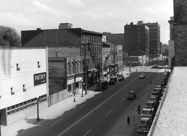
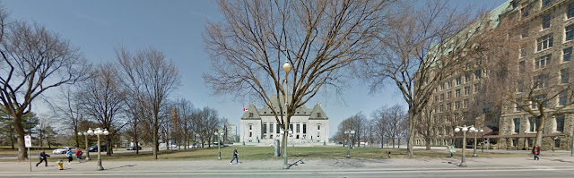
The next scheduled post will feature a selection of 50 photographs like this one. They were bound into three heavy volumes that documented the weekly progress of demolition work at the old Centre Block - between April and August, 1916. (Found in the vast holdings of the Public Works Records Group at Library and Archives Canada Acc NPC1959-084, Vol 2237.) These albums are dark, the photos still smelly from fish skin mounting glue, and minutely detailed. The annotations appear to have been hand lettered with radium paint. Those photographs should answer one question - how was the building dismantled? There are many more questions that may never be answered. Before proceeding to the demo pictures some background is necessary, so this is the prequel.
The burning of the Centre Block on Thursday, February 3, 1916 is still wrapped in mystery. One hundred years later the fire's true cause remains unresolved and the actual condition of the building's structure following the fire is open to dispute. Could the original Centre Block have been rebuilt within the remaining walls, and did the decision to demolish it make Parliament Hill the scene of the nation's worst act of heritage property vandalism? Overshadowed by the epic events of World War I the story is a tale of political differences, a lack of Parliamentary and Departmental oversight, and architectural ego.
It was one of the most dramatic events in Canada's parliamentary and architectural history. The details are well known - a lit cigar carelessly tossed into a wastepaper basket; closing the Library of Parliament's iron doors just in time, saving it while leaving the rest of the building a smoking ruin; and the great clock bell continuing to toll the hours throughout the blaze until just after the stroke of midnight - when it crashed down through the tower to the ground. Myth or Fact?  Some stories can be embroidered to heighten the drama, like the bottom image of the fire as it reached the top of the Victoria Tower
The retouched photo is from a photo album entitled Canadian Parliament Buildings Pictorial Record, A Series of Photographic Views Showing the Parliaments Buildings as They Appeared Before and After the Great Fire of February 3, 1916 (Ottawa Heliotype Co., 1916) published soon after the fire, before the initial decision to rebuild the Centre Block within the existing walls was unilaterally undermined and ultimately overturned by the architect of the new Centre Block, John Pearson. Perhaps it was a prescient slip-up that in celebrating the original building's 'fine old Christian gothic architecture' the album booms 'The design was the expression of the genius of that noble architect John [actually Thomas] Fuller'.
And what was really lost? Upon inspection of the new building after it opened in 1921 many old-timers reported that they missed the richer details and variegated stone colours - Nepean sandstone ranging from olive, to white and mustard yellow, with red Potsdam stone trim. Pearson had found the  polychrome to be vulgar and antiquated. In redesigning the building he flattened out the heavily textured walls, toned down the picturesque profile and insisted on monochromatic beige stones. (LAC)
The front page news contained all of the ingredients in the story that have come down. 
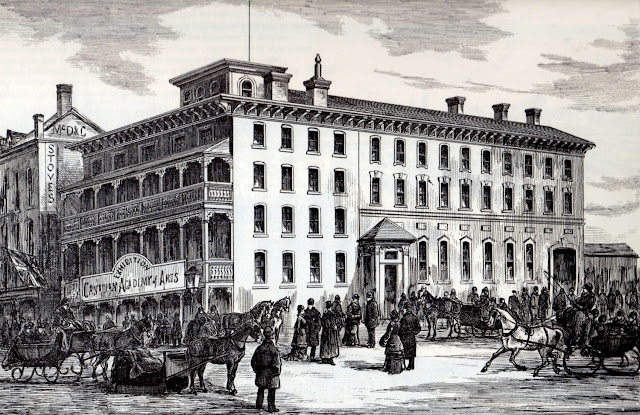
Great Edifice of Confederation is To-Day Mere Heap of Smouldering Ruins - Has Prussian Kulture Added Another Laurel to Its Crown of Shame? "Was Well and Truly Set," Says Chief; Five Explosions, Sure Were Shells. Did Hun Conspirator Start Fire Is Question Being Generally Asked.
Thomas Fuller and Chilion Jones' building was the centrepiece of one of the nineteenth century's greatest Gothic Revival ensembles.
The rear wall (north) of the Senate Chamber, near the heart of the fire, was examined two days after the fire. The timber structure carrying the roof and its monitor window lighting system had fallen in but the exterior stone walls were scorched but standing.
The Senate's side wall (east) was similarly solid. These sepia-toned photos were taken from the opening pages of an album registering the progress of the construction of the new Centre Block between 1916 and 1919.
And herein lies the mystery of the first phase of the reconstruction of the Centre Block in the months immediately following the fire, when this 'After The Fire' photo from the 1916 pictorial pamphlet was captioned  '..the walls remain intact and in fact undamaged. Rebuilding will not necessitate the removal of scarcely a single stone.'
The photos at the right are also from the pictorial album which promised that 'Fortunately the outer walls of the tower and building were uninjured, and will not need to be rebuilt.'
The quantities of water poured into the building and a chilly February night turned the facade into a frosty fairyland. The fire did not actually reach this easterly section of the Centre Block's front wall but it was heavily doused to halt the spread.
The facade's stonework once dried out. It appears skeletal here because deconstruction work had been proceeding in the building behind for about a month. And here's the burning question. Did the walls have to be taken down? This photo is from the April-August 1916 demolition progress albums that will feature in the next instalment of this post.
On Monday, February 7, 1916 the Ottawa Journal printed this unexpectedly optimistic assessment of the 'Semi-Ruins' and the 'Surprising Lack of Wreckage in Some Places'. It reported that the damage was not nearly as bad as supposed and that large portions of the building were as good as they were before the fire. Former Chief Architect David Ewart, who was assigned the task of clearing away the debris, opened a special operations centre in the Senate offices where the steam was on 'as though nothing had happened' while the electrical lights were on as usual. The central boiler room, and the electrical transformers and circuit room were also entirely intact.

It was the large central volumes without closely spaced masonry walls to provide fire breaks that suffered complete destruction. Because the Senate Chamber was a slight distance from the source of the outbreak there was sufficient time for the firefighters to carry out some of the ceremonial objects like the Speaker's Chair and the Mace. (LAC)
The roof collapsed but the Senate's interior walls were left partially standing, although stripped back to their bare brick structure.
The photos have the handwritten annotations 'The Senate Chamber' and 'Where the Speaker Sat - The Morning After the Fire'.

The House of Commons, which in the original Centre Block had an east-west axis with the Speaker's Chair on the side of the chamber, was nearest to the source of the fire and was fully engulfed shortly after the fire started. (LAC)
Looking north, with the Commons entrance door in view, the total damage to the masonry walls is evident.
These photos of the still smouldering ruins were taken during the search for bodies.
In 1906 one corner of the Centre Block was squared off with an extension. Although the exterior of the new wing matched the original building, it was steel-framed, considered to be fire-proof and in fact survived the 1916 fire virtually undamaged. (LAC)
An optimistic outlook was re-iterated by Senator Edwards on February 8, 1916. The Senator believed that with a third to two-fifths of the buildings absolutely undamaged, large portions only slightly damaged, and the walls perfectly good the Centre Block could be put into even better shape that it was before the fire in less than 8 months - an opinion the Ottawa Journal called 'startling'.
Remembering that the flames had swept through the Centre Block's arched entrance hall on its way to turning the Victoria Tower into a fiery chimney - the before and after photographs of The Rotunda (where as the picture shows, 'the fire did little damage but the wood work was burned in places') tell an interesting story. Ironically the earlier photo, from the 1870s, includes a fire hose wound around a wheeled reel.
Areas nearest the fire's epicentre were heavily damaged - such as the hallway leading from the Senate to the Commons (left) and the corridor outside the doors to the Library (right).
Within the week specially appointed Commissioners Judge MacTavish and R.A. Pringle K.C, were conducting an official inquiry into the cause of the fire. Their sittings were wrapped up by the end of February and the Royal Commission's report was submitted in early May, by which point events on Parliament Hill had moved much further along.
A ground floor plan of the original Centre Block shows the positions of the Commons and Senate chambers in the centre of the building, to either side of an open court. The Rotunda was just inside the entrance through the tower's archway. The white patch on these plans (which predate the construction of the 1906 extension on the northwest corner) was intended for the renovation of rooms adjacent to the House of Commons Reading Room. (LAC)
This day-after photograph by Topley pinpoints the exact location where the fire had started. The House of Commons Reading Room was located at the rear of the building in a space that had originally been used by the Supreme Court and then as a picture gallery. It was immediately adjacent to the entrance to the Library of Parliament, separated by a narrow corridor that linked to two buildings. (LAC)
The hatched area shows the extent of the worst fire damage, with arrows indicating the progress of its spread. Owing to the 1906 extension, the ground plan for the Centre Block was asymmetrical.
This plan of the Reading Room was produced in evidence by Edgar Horwood, Chief Architect of the Department of Public Works at the Royal Commission inquiry into the fire. It was an interior room, 35x70 feet in dimension, lined with shelving for some 20,000 volumes. Six long reading tables stood in the middle of the room (tables 'A' and 'B', where the fire broke out, were constructed of hardwood). Surrounding them were screens on wooden posts, most holding newspapers hanging down from racks. A second floor gallery ran around the perimeter of the space. Rooms 28 to 33 were for the use of Cabinet Ministers.
This undated photograph shows a corner of the Reading Room, which in addition to its collection of highly combustible books and newspapers was lined with varnished wooden panelling and fittings. It could well be described as a very large tinderbox.
The 'Royal Commission Re Parliament Building Fire at Ottawa, February 3, 1916' hearings were held in Ottawa City Hall during the third week of February 1916. Evidence was adduced from more than two dozen witnesses who provided a range of contradictory opinions as to its cause and rate of spread. The Commission's findings were presented to the Privy Council on May 5, 1916. It had briefly reconvened that day to hear testimony from architect John Pearson who was responding to charges that the fire had been fanned by the Centre Block's ventilation system. Pearson's evidence did not make it into the final report.
The Commission's inquiry has been criticized for being hurried and inclusive. It is generally assumed that Pringle and MacTavish concluded that the cause of the fire was likely accidental but this is not completely born out by report's summation. They were certainly swayed by a demonstration provided by Ottawa Fire Chief Graham, who had opined that given its initial intensity the fire must have started with the use an accelerant.  They wrote: 'It is clear to us that the fire started on the newspaper with the chemicals, once it started burned with great rapidity. The fire started with the match burned very much more slowly. The one started with the chemicals was much harder to extinguish than the one started with the match.' The notion of a carelessly discarded lit cigar was discounted. They also dismissed the faulty wiring theory. Regarding the matter of an alien enemy plot, they took note of the sighting of suspicious strangers but could not rely on corroborative evidence from the recollections of the police and strongly suggested that the Government should try to obtain more evidence at a later date.  And on the fundamental question as to whether the fire was set they offered this startling statement: 'Your commissioners are of the opinion that there are many circumstances connected with this fire that lead to a strong suspicion of incendiarism..'.
Whatever the causes, could, or should, the walls of the Centre Block been saved and new legislative chambers rebuilt within? As with the likely source of the blaze there were many possibilities but misunderstandings, political squabbles, and architectural egos doomed the original Centre Block. As the Royal Commission was getting underway a special Joint Committee of the Senate and Commons was formed to oversee the work of reconstruction. (LAC)
The Parliament of Canada and Pubic Works websites make two assertions: 'On February 3, 1916 the Centre Block burned to the ground.' and that 'After it had been decided that the Centre Block would be completely rebuilt, a team of architects was chosen to produce a design that look [sic] as much like the old building as possible.' However, the contemporary newspaper accounts suggest that apart from the Senate and Commons Chambers much of the building was surprisingly undamaged - and the team of architects was engaged within a week of the fire to prepare plans to rebuild within the existing walls.
We've been left with the impression that save the Library of Parliament all that remained of the Centre Block was a gutted ruin.
More conventional wisdom regarding the state of the building on the day following from the Canada On-line and Radio-Canada International websites: 'The Centre Block was a smoking shell filled with icy rubble..' and 'By the next day, the fire was out, but the structure was a smouldering icy shell.'RCI continues by promoting the lit cigar theory... 'the fire was widely rumoured to be an attack by saboteurs, however although never determined, its [sic] now thought that it began with a carelessly discarded cigar in a waste basket. Another theory is an electrical fire as the reading room had recently been wired for electric reading lamps.'
The first evidence of architects John Pearson and Omer Marchand early involvement with the remodelling of the buildings is found in a sequence of three small clippings from the Ottawa Journal. They were called upon to make a preliminary assessment just one week after the fire. A week later they reported that they fully expected Parliament to meet again in the old building within the year, finding the Centre Block walls intact and the whole west wing practically undamaged by the fire. 'They pointed out that the old building was semi-fireproof, hence the slight damage to the walls.' However it gradually emerged that they didn't want to be encumbered by the surviving walls or the awkward presence of the new wing.
There appears to have been general confusion on the part of the politicians and the Departmental officials as to whether the old walls were to be torn down. From Fire on Parliament Hill, Jane Varkaris, 1988'There was much criticism by some of the members of Parliament and the press against the decision to tear down the walls left standing after the fire..  Many thought that the decision had been taken an acted upon in haste without proper discussion'. Even the Department of Public Works was unaware of the architects' intentions: 'As early as May 23, 1916, Deputy Minister Hunter had complained in a telegram to Mr Pearson about the manner in which the two shifts of wrecking crews were handling the stone. On June 20, he requested details of the arrangements that were being carried out to mark the stone that was being taken down to be stored. ..on June 27 he requested an immediate answer to "what portion of the walls is to be left intact and what portion is... to be taken down carefully for the purpose of reusing."'
Following the presentation of a draft sketch of the proposed remodelling to the Minister of Public Works on February 22, 1916, the March 1st issue of the Contract Record reported that 'with the exception of the central interior and the rear walls the structure itself can be repaired without entirely rebuilding. Most of the walls are still intact.' Four weeks later on March 29, 1916 plans for the remodelled Parliament Building were completed and placed on exhibition to the Members. The CR reported that the main feature was 'the preservation of the present architectural scheme of the whole front elevation as it now stands.' The word 'preservation' may be ambiguous. In his CR 1919 account Pearson indicates that by this point he had precluded the possibility of using the old walls in any way, although the Joint Committee and Department of Public Works may not have been so inclined. The primary change in the March 29th plan was to move the legislative chambers to the outer corners of the buildings, necessitating 'the tearing down of the new west wing, which was undamaged by the fire, but which did not preserve the original architectural harmony of the whole building.'Pearson had previously experimented with adding freestanding chambers projecting from either side of the building like the Library, but this was rejected as balky and awkward. The decision to demolish the new west wing was never ratified by the Committee, and it would appear to have entirely made by the architect himself. In defending this before the Joint Committee John Pearson recounted that 'Several schemes were plotted endeavouring to retain the west wing, but it was found impossible to get a properly balanced plan. We had ultimately to discard this idea. We were convinced that no satisfactory plan could be arrived at by endeavouring to tack the [new] building on to the west wing.'
There were howls of protest from the Liberal Members of the Joint Committee when it returned to Ottawa to find the old Centre Block, including the new wing, entirely gone.  On August 9, 1916 Pearson reminded the Committee that in the course of earlier deliberations at their request it had determined that in order to increase the size of the offices a third floor should be added and 'that a new elevation be prepared showing an additional storey, provided the general design of the Buildings would not be interfered with or altered'. This would have required removal of the old south walls down to the level of the window sills, and in making test bores the architect had determined that they were insufficiently strong to bear the weight of an extra floor. There was never a clear confirmation that the initial inspection was correct, and that without the addition they could have been retained. The Committee split along partisan lines, with the Conservative members closing ranks to defend the actions of Pearson.
COMING UP: Part 2 -The Demolition

HAT BOX

$
0
0
Yesterday a friend was hauling stuff off to the Salvation Army and sent me this picture. Hat boxes from four long gone department stores. 'Boring hats, nostalgic about the boxes...' she wrote. It unleashed a flood of memories. More Lost Ottawa territory than Urbsite, but before resuming the grim business of demolishing the Centre Block I can't resist this moment of commercial nostalgia.
Freiman's Downtown and Westgate - Two fine Department Stores To serve YOU. Turquoise was the store's official colour.
The poles of Ottawa's downtown department stores were formed on two streets - Rideau and Sparks, each dominated by a pair of rivalries. (Photo: CA)
Around 1960 Freiman's corporate logo evolved from a free script into their interlaced 'Fs'. They had expanded into the Westgate Mall in 1955 - for ideal suburban shopping. Both stores had ample parking. Downtown it was in the Parking Centre/Parkade behind Freiman's on George Street, connected by an air-condtioned tunnel under the street.
In the nether regions of The Bay's basement a few weeks ago- the 'Tunnel To Parking Deck' sign still illuminated but the doors were firmly locked.
Ottawa households were often divided into two camps - you either took the Ottawa Journal or the Ottawa Citizen, and you shopped at the waspish Ogilvy's or the slightly more cosmopolitan Freimans.
The Charles Ogilvy Limited buff brick block in the late 1940s after four campaigns of construction. For the Rideau Centre expansion of 2013-2016 it was reduced to a reconstructed replica of two portions of its 1907 walls. Nice gesture, but consolidating the whole shebang would have been so much more meaningful. (Photo: CA)
In 1950 Ogilvy's launched a period of expansion and modernization - replacing its original Edwardian storefront with this. The heavy chains holding up the marquee are leftover and apparently couldn't be disguised. (Photo: CA)
The store always put on a big show at the Ottawa Ex - filling several display modules in the Manufacturers' Exhibit (Aberdeen) Building with an array of gowns, living room suites, and automatic washing machines. (Photo CA)
At Ogilvy's padded toiletries and personal care counters a promotional display for new Shield toothpaste. Next door, a range of hot water bottles.  (Photo CA)
Tracking the milestones of growth of Charles Ogilvy Limited from a dry goods store in 1867, to a three-story building at Rideau and Nicholas built in 1907, and expanded in 1917, 1931 and 1934; the Nicholas-Besserer Annex of 1953; and the West End Branch at Richmond Road and Winona of 1956.
Ogilvy's 1950 announcement of their new four-story Annex on Nicholas Street tied the expansion to Greber - it was 'designed to harmonize with the National Capital Plan.' It served home furnishings, appliances, and sports equipment. The building was diagonally opposite the mother Ogilvy's, on the southeast corner of Nicholas and Besserer Streets, so the Mackenzie King Bridge depicted in the drawing as being visible in the distance is artistic licence.
Ottawa's local department stores were notable for remaining under local ownership long after most of the country's stores were swept away by the big chains.  Ogilvy's was the last major independent to go, although it suffered a long slow decline ending its days as a relatively down-market Robinson-Ogilvy. Their expansions downtown, at Billings Bridge, and finally at Lincoln Fields which replaced the tiny Winona Street West End Branch were insufficient to buck the national trends of amalgamation and big box conversions.
Morgan's on Sparks Street between Elgin and Metcalfe operated as the Ottawa branch of Montreal's Henry Morgan Company very grand store on St. Catherine Street.
Morgan's had assumed ownership of the venerable R.J. Devlin store in 1949-50. After Henry Morgan had been bought out by the Hudson's Bay Company the Ottawa branch continued as an HBC store until 1972, when The Bay took over Freiman's Department Store on Rideau Street and closed their Sparks Street business.
For many years the Sparks Street Morgan's continued to use the former Devlin's storefront (an amalgam of several buildings) which included a pair of curved glass display windows that were a victim of a 1960s modernization.  (Photo: CA)
When were discussing Ottawa department store history my friend described Morgan's as being stuffy. From this view towards the second floor fur and dress salon you can see that much of the merchandise was still firmly behind counters. No pawing through racks here. (Photo: CA)
Murphy Gamble Ltd. was at the apex of Sparks Street's many department stores. Their signature boxes featured broad grey stripes.
Built as the Carling Building (1909, C.P. Meredith, Architect) Murphy Gamble's fully glazed Sparks Street elevation, efficient elevators in an interior light court and reinforced concrete frame incorporated all of the elements of a modern department store. (Photos: CA)
It never expanded into any of Ottawa's suburban shopping malls, and Murphy Gamble's management welcomed the creation of the Sparks Street Pedestrian Mall - shown here in its first temporary installation during the summer of 1960. In 1969 the building, which they did not own, was purchased by Simpson Sears Ltd. and Murphy Gamble entered its twilight years awaiting eviction. The location was re-opened as a Robert Simpson Ltd. department store which operated here through the 1970s.
Murphy's tried to extend its carriage trade style of business well into the 1960s. Some of their retail practices sound impossibly anachronistic for the times.  The Shopping Service would 'gladly make purchases for you - a boon to Summer cottagers. Just drop a note or telephone.' I suppose that people without cottages didn't count, because the store was closed on Saturdays during July and August. Today you could say that Sparks Street is closed every day of the week, year round.

TRIAD

$
0
0
The Tribute to Liberty Foundation has left the hill. Opponents of their ill-considered National Memorial to Victims of Communism had several good arguments. It was gratuitously harsh, hopeless, and irrelevant to the national identity; it wrecked a scenic view of the Supreme Court of Canada; it was being built on valuable land long designated for the completion of the 'Judicial Triad'.  This trio of law-related buildings has also been referred to as the Judicial Promontory, the Judicial Precinct, and (Louis) St. Laurent Square.
The debate was a heady mix of politics and planning polemics. If there was an upside to this nasty business it was a public discussion about architecture and design, the kind of discourse that rarely reaches such national dimensions. (Left: ABSTRAKT Studio Architecture)
Well... where were we before the controversy over the NM for Vs of C erupted? Plans for the site have been underway for over 100 years. Successive governments have commissioned, revised and rejected. Taking into account all of the prior architectural competitions and design concepts there have been no less than 20 different buildings proposed for this site.
This is how matters stood when the Pierre Elliot Trudeau Federal Courts Building was cancelled. 'A planned federal justice building, which will house several of the country's top courts, will be named after former prime minister Pierre Trudeau. In one of his last acts before leaving office next week, Prime Minister Jean Chrétien announced yesterday that the new courthouse will be called the Pierre Trudeau Building in honour of his old friend and mentor. The $151-million building, designed by architect Carlos Ott of Toronto, will house the Federal Court, the Federal Court of Appeal, the Court Martial Appeal Court, the Tax Court and their administrative offices. The courts and their staffs are currently scattered throughout downtown Ottawa. The nine-storey, sandstone, copper and glass courthouse will sit next to the Supreme Court of Canada building. Construction is planned to begin next fall, with completion scheduled for autumn, 2007.'  Globe and Mail, December 3, 2003  The design (with NORR Limited and Edmundson Matthews Architects) subsequently received the American Institute of Architects 2005-2006 Citation for Outstanding Justice Facilities. Hmmm. If the PET Building is to be resurrected, is it time to reconsider this overbearing Chateau-style ape?
The Judicial Triad would be completed by a third building mirroring the height and scale of the Justice Building. A previous version of the Judicial Promontory's 'missing element', from the Parliamentary Precinct Plan (1987, du Toit Allsopp Hillier) suggested a more asymmetrical massing for the Federal Courts building.
Some years later, just before the change in governing Party, the Ott plan was acknowledged in the Parliamentary and Judicial Precincts Area Site Capacity and Long Term Development Plan 2006 Update (PWGSC du Toit Allsopp Hillier). 
All of this ground to a halt with the election of a new Government, which wanted to pursue its own plans for the Precincts. The Triad would remain a Biad, or maybe a Diad.
Taken either way, the district is scheduled to receive a lot more floor space.
The Public/National Archives of Canada-National Library, and now Library and Archives Canada (Marani and Morris, 1955-1965) is the only Wellington Street institution to be built in a non-historicized style, but if enlarged it could have been wrapped up in one.


Until 1912 there were no plans for Wellington Street between Bank and Bronson, although since then there have been plans aplenty. The planning was initiated when the Government abandoned its 1907 proposal for transforming Sussex Street into a row of grandiose departmental buildings and the location of the Exchequer Courts (but not before they had demolished the western half of the street). In February 1912 all of Ottawa's Uppertown lying between Wellington and the Ottawa River was expropriated. For a look at the incredibly interesting neighbourbood that disappeared by sure to check Andrew Elliot's Streetscape Memory Bankhere and here.
Although he had no specific remit to do so, on a visit to London Prime Minister Borden asked architect Sir Aston Webb (Victoria and Albert Museum, Buckingham Palace, Admiralty Arch) to present a concept for Wellington Street. The resulting plans, prepared by landscape architect Edward White and published in July 1912, were truly imperial. At the same time the Ottawa Improvement Commission, through C.P. Meredith, invited Frederick Todd (of the 1903 Todd Report) to return to the city to draft the layout of buildings and landscapes for the same area. Neither scheme was accepted by the Government.
Instead, in 1913 the Department of Public Works staged a national competition which drew entrants from most of Canada's leading architects, including this domed ensemble a la St. Peter's by John Lyle.
The winning entry from Maxwell and Maxwell featured a relatively uninspiring court building surmounted by a tower meant to echo the Victoria Tower on Parliament Hill, and flanked by two ponderous departmental blocks with Sir Christopher Wren-ish corner turrets.
However the results of the 1913 competition were disregarded when the Holt Commission was formed to devise a more comprehensive master plan for Ottawa and Hull. Architect Edward Bennett's plan for Wellington Street encompassed very long continuous departmental blocks along the street, opened up for a triumphal gateway arch on Lyon Street and positioning the court building in front of an inner plaza hidden from Wellington. The Holt Report (1915) was overtaken by the events of WWI and it was effectively shelved.
This sequence of schemes included in the 2006 Parliament and Judicial Precincts which missed a few (like the Aston Webb plan of 1912, the 1913 Competition, and the NCC's Ottawa Downtown Development Plan of 1961) demonstrates how heavily the area has been planned. Following Holt, in the early 1920s Chief Architect Richard Wright and town planner Thomas Adams recycled pieces of the Bennett plan which returned the concept of an open lawn in front of the court building reaching to Wellington Street.
Jacques Gréber 1938 plan is less well known than the more ambitiously epochal 1950 National Capital Plan. West of the Ernest Cormier Supreme Court (which he inherited but modified with steeply pitched roofs) two monumental blocks on either side of Wellington enclosed a vast court on the Lyon Street axis. The 1950 plan replaced this with what would eventually become the East and West Memorial Buildings and archway leading to a cultural institution such as the National Theatre. (LAC)
Although Gréber's 1938 Wellington Street buildings were generally Chateau Style, the edifice straddling Lyon Street (possibly for civic purposes) could be described as Flemish Revival. (LAC)
The 1987 Parliamentary Precinct Plan was integral to the NCC's Ceremonial Route, with its much ballyhoo'd red pavement.
The National Capital Commission's 1961 Ottawa Downtown Development Plan placed a National Performing Arts Centre south of the Memorial Buildings, on an axis with a new National Gallery north of Wellington Street. The west side of the Judicial Triad would be walled off by a simple office block.
The recommendations of the Hammer Report (Hammer, Silas, Green 1969) was the basis for 1971 NCC Core Area Plan, although that eschewed the building of a block-long building right in front of the Supreme Court.
The dream of interconnecting the Wellington Street buildings continued. The 1987 PPP made allowance for an underground concourse extending from Parliament Hill to the Library and Archives Canada. Underground parking for 2050 cars would replace the surface parking lots that now blight the wooded hillsides. This is a notion that dates back to the early 1960s.
The 2006 update also drives the services and circulation underground.
One of the most grievous elements in the 1987 PPP was the linking of the Confederation and Justice Buildings with an 'Infill Expansion' carried out in a modern rendition of the Chateau Style
The infill would have obliterated the inspiring views that are created by the space between the two buildings.
Filling every conceivable inch, it would have projected beyond the northern facades of the Confederation and Justice Buildings, burying their corners under the addition.
By the time of the 2006 update slavish copies of Chateau Style buildings were seriously out of fashion, and the infill was simplified and shrunken, leaving open inner courtyards.
Aerial views of the Confederation and Justice Buildings before and after. Ottawa's steep copper roofs and their picturesque profiles have become national architectural symbols. Is their primacy under threat by any current plans?
The 2006 building envelope for a Confederation and Justice infill would be pulled back just enough to view the south and north building faces but the Bank of Canada axis, so carefully aligned to match the gap between would have been blocked.
And something else has been added - a freestanding building on the 'West Terrace' adjacent to the West Block.
Parliamentary Precinct planners have long wanted to dig under the West Terrace and relandscape the top.
The 1987 PPP demonstrated this.
If this ever rears its copper head again, there needs to be another public debate about national symbolism, architecture and urban design.
A view of the West Block along the Mackenzie Tower axis once Parliament Hill's fourth building has been added.
Who could forget Saucier and Perrotte's winning entry in the Bank Street Competition, certainly not guilty of being a cheesy faux-historical building, but raising the question of whether any new building should be added to Parliament Hill.
These sight planes attempt to justify a new building here. A height limit established by the Confederation Building eave line isn't very reassuring.
It isn't the first building proposed for the West Terrace. The 1938 Gréber Plan added one that would serve the Privy Council and Prime Minister's Offices. (LAC)
Another bullet dodged - the first stage of the proposed Wellington Street south side infill opposite Parliament Hill.
There have been concepts for a South Block. As completed the 1987 infill would have been half-hearted and piecemeal.
The National Portrait Gallery attached to the former US Embassy on Wellington (waffle roof) would have partially filled in the block, which to this day remains derelict and ratty.
I've only skimmed the surface. The well of architectural fantasy never runs dry. In preparation for the 1937 visit of Jacques Gréber to Ottawa for preliminary field investigations the Department of Public Works presented this updated variant of the Wright-Adams plan on display in the lobby of the House of Commons. (LAC)
A steroidal Chateau-style behemoth would have stood on the site of the Judicial Triad's third side, with design input from W.E. Noffke. (LAC)
Time for another try. (LAC)

URBANISM ONLINE: NCC LAB on JAN 14/16

$
0
0
URBANISM ONLINE - a Brave New World for discourse, or a self-selecting closed loop? The National Capital Commission's next Capital Urbanism Lab has invited bloggers from four Canadian cities to debate and discuss. Every municipal government wants a Facebook page, a twitter account, and a suite of apps. Architects, green advocates, and community activists are issuing a daily stream of opinions, observations, and energetic fanaticism for urban design and city life. Where is it all headed?  Hopefully something anarchic but useful - with lots of good pictures.
Marc-André Carignan, blogger at D’ici et d’ailleurs /Kollectif.net, produces a Montreal-based magazine-format site for architecture and development news.
Brandon G. Donnelly of Toronto writes a daily city blog Architect This City with provocative personal and professional postings and many links.
Jillian Glover posts a tumblr This City Life about Vancouver's lively neighbourhoods, pubic spaces and urban issues.
Rounding out the URBANISM ONLINE LAB is URBSite - a quaint corner in Ottawa's active online neighbourhood that explores architectural history and the lessons of planning.  This city has developed an array of commendable bloggers, Instagrammers, and website hosts. Here are a few of my favourites ...
Some of Ottawa's best online architectural imagery is posted on Christopher Ryan's INSTAGRAM.
The STREETSCAPE MEMORY BANK at Apt613 by Andrew Elliott offers carefully researched postings about Ottawa's streets and neighbourhoods.
OTTAWAHH by John West hosts comprehensive online historic photo galleries, links, and maps.
OTTAWA PAST and PRESENT (Alexandre Laquerre) is the essential 'Then-and-Now' site, with a sliding dissolve bar.
LOST OTTAWA's phenomenally successful Facebook page posts hitherto unseen photos from family albums, personal recollections, and highlights from the archival collections.
Eric Darwin's WEST SIDE ACTION provides a running commentary and detailed analysis on the built environment. A go-to site for planners and activists.
Online tools like geoOttawa have opened up a whole new world of possibilities for playing with raw data.
For more details on the NCC's Capital Urbanism Lab go here: URBANISM ONLINE

CENTRE BLOCK FIRE 1916-2016: 'TAKE DOWN THE WALLS'

$
0
0
As a further warm-up to the Bytown Museum's 100th anniversary exhibition on the burning (and rebuilding) of the Centre Block, this is a return to the selection of photographs from the Department of Public Works'album that documented the demolition of the building between April and August of 1916. The grim job of hauling away so much stone had to be organized with military precision. Here, told mostly in pictures, is how the building came down.
(Annotated demolition photos and architectural drawings: LAC)
By Empire Day in 1916 (May 24th) spruce timber scaffolding was erected over the Victoria Tower and the central sections of the south wall.  A week later it extended the length of the Centre Block's facade. Surprisingly, the Empire Day spectators could gather right under the building, and on the Commons steps,  to watch the parade (top). It was fenced off during the demolition, and during most of the reconstruction years the lawn remained open to the public.
Thomas Fuller and Chilion Jones' building was a full-throated expression of the Gothic Revival, heightened by its multihued stones and thickly textured walls.
April 11, 1916 - these sections, east and west of the tower, were said to be the most fire damaged portions of the front wall.
The Centre Block fire had broken out around 9:00pm on Thursday, February 3, 1916, and was brought under control by 1:00am on Friday, February 4th - although it continued to smoulder and break out in spots that day. By Monday, February 7th Chief Dominion Consulting Architect David Ewart was installed in a field office in the Senate office wing and charged with superintending the task of clearing away the remains of the House of Commons and Senate chambers. He was immediately tasked with the demolition of the most heavily damaged parts of the building, and remained in charge until March when the responsibility was handed to John Pearson, architect of the new Centre Block.
To give a sense of the colours of the original masonry you need to visit W.L. Mackenzie King's 'Abbey Ruins' at Kingsmere (designed with the help of architect J. Albert Ewart). After the fire some stones from the Centre Block were salvaged by the Department of Public Works for investigation by the Royal Commission of Inquiry into the cause of the fire. They remained in a rented warehouse for over twenty years when King was tipped off to their existence. In 1937, hearing that the storage building was due to be demolished the Prime Minister arranged for a visit to inspect them with the Deputy Minister and the Chief Dominion Architect, and purloined the stone for his own uses.
Once both chambers were removed the Library of Parliament was freed from the building. This view is looking east through the gap towards the Connaught Building.
The wooden scaffolding was built with great precision.
June 9 and 14, 1916. The removal of the Senate Chamber and House of Commons' debris edged toward the rear of the front wall.
Interspersed with a ground plan of the building, and a tinted section drawing from the office of Fuller and Jones, the middle of the Centre Block with the large square chimney tower that had been connected to the boiler room were still standing
The stonecutters' building was being erected off site as demolition on Parliament Hill proceeded. It was a four block long shed built on the west side of Sussex Drive, land that had been expropriated and cleared for the Government's abandoned pre-WW1 plans to build the Exchequer Court and Departmental Buildings. Needing unprecedented amounts of cut stone manufactured on an industrial scale (mostly Nepean and Tyndall limestones) to dress the outside and the inside of the new steel-framed Centre Block, the contractors had to set up assembly line operations that would take the stone through steam-driven gang-cutters from rough blocks to finished panels, all carefully numbered and keyed to the architects' shop drawings. At the peak of production hundreds of masons and hands could be working here.
June 19, 1916. Three of the contractor's outbuildings and field offices that were put up on the job site.
As the heavy stone walls were broken down to rubble teams of draft horses stood ready to cart it away - to where I don't know, but taken all together they must have made a very big pile.
It is striking how the demolition scene resembled the Great War's devastation a continent away,  the destruction of Ypres.
By July 1916 most of what remained was the stump of the boiler room chimney and the fireproof steel-framed 1906 addition to the Centre Block.
The commemorative statues were left in place, their bases securely boxed up for protection.
July 7 and 11, 1916.
The demolition left an open wound on the Library of Parliament
Most of the debris was piled and taken away from the north side of the building, but apparently some spillage at the front was unavoidable. The hose and water puddle suggest a form of dust control.
By July the tower was entirely gone, and the scaffolding could be dismantled.
July 14, 1916 - the older section the Centre Block was down to its foundation walls, as demolition of the final section (the new wing) was underway.
There are many versions of this arresting image - here are two more. For a time delegations liked to gather on the steps to nowhere, to have a group photo taken in front of the missing Centre Block.
What remained was the masonry membrane that had been laid over the building site in the 1860s.  These images juxtapose the full cycle of this sad turn of events. At the top, the ghost of the Centre Block with just the Library remaining. At the bottom, a ghostly sketch of the Library as its design was being worked out by the architects, attached to a fully conceived Centre Block.
By September 1916 the site was pretty much cleared and footings for the new Centre Block were going into the ground.

ALTERED 'REALTY' - THE UNBUILT

$
0
0
Cruising through old newspapers unearths a long forgotten trove of architectural projects. Ottawa's developers announced them with brimming doses of confidence, unleashing a steady stream of visions for new buildings. But most of them would never be built. The majority were very ordinary, a few were wild, and some were horrifying. Having read about 100 years' worth of Ottawa dailies, the ratio of built-to-unbuilt seems to be about 1 in 10 (if you include both public and private sector development). Unfortunately the image quality of the newspaper illustrations isn't always web-worthy, but occasionally these schemes are too good to pass up.
On March 14, 1961 the Board of Control gave its preliminary blessing to a $10 million project to raze and rebuild two-thirds of a block of Sparks Street. The city would expropriate a bank, four office buildings, seventeen stores and two restaurants.  They would be replaced with a development designed by Peter Dickinson Associates, rebuilding the stores and topping them with a 900-car garage and a private landscaped deck surrounded by a 400-room hotel. City officials said they hoped it would be a harbinger of similar developments to come.
The Sparks Street hotel and its inner courtyard were certainly inspired by Dickinson's just-completed (1961) Four Seasons Hotel in Toronto. To stay within the city's zoning by-laws the hotel would be four storeys, but provision was to be made for a further two at a later date. Like its Jarvis Street exemplar, Ottawa's version was meant to cocoon the guests in a private landscape separated from its urban environs.
It was the first time that the City of Ottawa had planned to exercise its powers of expropriation to assemble land for a private developer, who would hold a 99-year lease on the property. As outlined by Frank Ryan, Chairman of the Parking Authority 'The offer is firm and the project will take two years to complete. It will cost the city nothing. Overseas money will be used.' Mayor Whitton called the project 'imaginative' and immediately came up with a name, the 'Esther By Building', after the wife of Col. John By. (Ottawa Journal, March 16, 1961) ...Enough said.
Partially Unbuilt: The Ottawa City Hall on Green Island might have had a tower. A caption accompanying the drawing at the top, from the March 3, 1956 Ottawa Journal reads:  'The Two City Hall Plans - This is a composite drawing which shows how the new city hall would appear from the Quebec shore, both as envisaged by the city and by the Federal District Commission. Cover up the tower on the building and you see it as the city plans it. Cover up the top four stories of the two wings beside the tower, and you see the building as the Architectural Subcommittee of the FDC suggests it should appear.'
Inside - the proposed 'Nerve Centre' Floor at City Hall for the Council Chamber and its anterooms. The Aldermen's traditional horseshoe was altered into a square of moveable desks and the 'Balconey' reduced to a symbolic gesture on the front of the building. Adjoining were the Mayor's Parlour (left), and the Robing Room, the Women's Sitting Room and the Men's Sitting Room (right). While architecturally it may have been a thoroughly modernist building its functional programme was stranded in another century.
The Mayor's office became his (and then her) office. In square footage, the biggest in town and decorated with a suite of very modern custom-built furnishings. (Photos: Panda)
'The dotted lines at the back show the position of a possible extension of the administration block, should it be decided some time in the future to enlarge the building.' It was enlarged but without a tower. (Ottawa Journal, March 3, 1956)
It's fair to say that this blimpish apartment tower on Laurier Avenue East (1969, G.E. Bemi and Associates, for the Bourque Brothers) was a tipping point for the creation of the Sandy Hill Neighbourhood Plan, which downzoned the area and enacted heritage preservation legislation. In the end the site was grandfathered for high-rise development and Minto built their 373 Laurier Ave condo here (right). It was two storeys lower, but maybe the blimp would have been better.
Another project (and another Bemi building) initiated by the City of Ottawa Parking Authority (1973) for the block between Slater and Laurier across from L'Esplanade Laurier - 'Laurier-Slater Center'.  This Ron Engineering proposal by G.E. Bemi and Associates featured two mighty office towers on top of a parking structure with a landscaped deck.
 MerBan Capital Corp. Ltd. of Toronto submitted a three-tower apartment hotel (architect unknown).
The second version of the Ron/Bemi complex, beefed up for another proposal call for the same site in 1974, included a beveled office tower and a luxury apartment in its baby brother, with commercial outlets. (Ottawa Journal, February 1, 1973 and May 30, 1974)
The City of Ottawa eventually sold its municipal lot for this - a public parking structure and phase one of a two-tower office development (David McRobie Architect). Too bad. Had the 1973 project succeeded it might have been Ottawa's best Brutalist/Metabolist block.
After the Russell House hotel closed in 1925 and burned in 1928, the search was on for a major new hotel. Local businessmen and city alderman solicited proposals from across North America and finally snagged this one - 'Front elevation of the hotel building to be erected on the west side of Metcalfe street between Albert and Slater streets. Options for this property were signed this morning by E.E. Hampson on behalf of an American hotel syndicate. According to Mr. Hampson the project is to be pushed this summer and all major financing has been arranged.'(Ottawa Journal, May 25, 1928)  It wasn't built.
One of the four proposals submitted after the Board of Control's 1971 tender call seeking a developer who would build the new Ottawa Public Library - the Olympia and York 18-storey office tower on the north side of Gloucester, just across the street from OandY's recently completed Place Bell Canada. The library was to go into the basement and the first two floors. These developers were the high bidder, and lost. Many years later the City of Ottawa, which owned the site,  sold the Gloucester Street lot for the 150 Elgin Street development (right).
A rendering and general plot plan of the  'Proposed Magnificent New Hotel for Ottawa which G.T.R. Offers to Build. Station is Shown in Rear.' Constructing the railway terminal and its hotel in the centre of the city was a saga as monumental as the buildings themselves. Begun by J.R. Booth's Canada Atlantic Railway, which was sold to the Grand Trunk Railway, the project was fiercely debated by the City of Ottawa and the Government of Canada. This early proposal (1907) placed the hotel on the south side of Rideau Street,  with a large plaza and the passenger station behind. On the west bank of the canal was a new highway connecting Parliament Grounds with the Canal Reserve lands and the Ottawa Improvement Commission Driveway. (Ottawa Journal, February 2, 1907)
Built not Quite as Planned: The G.T.R. Union Station, with domed rotunda and flanking wings, was subsequently transformed into a castellated building and moved further north. Architect Bradford Lee Gilbert's plans separated the station and the hotel by setting them on either side of Rideau Street, and he would soon be separated from the project, replaced by Ross and Macfarlane Architects who returned the building to a robust Classical Revival.

LEBRETON FLATS: BETTER THE 54th TIME AROUND?

$
0
0
It's time to chime in on Lebreton Flats. Canada's longest-running urban renewal and brownfields regeneration project has reached another fork in the road - two competing proposals for redevelopment that have spread out a buffet of options. This post is intended only for the purpose of historic background and won't help you vote for your favourite plan. I agree with West Side Action's running analysis of the Flat's most recent planning episode, if any of the following schemes had actually been built out, the results would have been monotonous. Bullets dodged. 
The first post-expropriation vision for Lebreton Flats, 1962-63.

Why is it so hard to finish The Flats? This month the National Capital Commission reveals the results of its latest effort to redevelop Lebreton Flats. Developers were invited to submit their proposals for the north and south parcels of land between Booth and Preston Streets. Here is what the NCC was asking for - a ‘Public experience anchor institution defined as an organization that runs an anchor use of the site that is of regional, national or international significance. The institution could be a private, public, not-for-profit or public-private organization that attracts the public to visit the site and that complements, and shows compatible uses with, the surrounding attractions.’  (Taken from a recent article in The Centretown Buzz).

NCC Open House on Lebreton Flats Development Proposals: January 26 and 27, 2016, 8:00am to 9:30pm (presentations start at 4:00pm) - Canadian War Museum. On-line comment period: January 26 to February 8, 2016.

Despite being a Federal project, the Flats was crisscrossed by a layer of networks controlled by other levels of government. When first expropriated 60% of the land was being used by the railways. The streets and public rights-of-way were owned by the old City of Ottawa. The former Regional Municipality had control of easements for sewer and water services. With its domain over these networks the local governments used this bargain chip to exercise some control over the planning process. It wasn’t until 2000 that the amalgamated City of Ottawa entered into a Plan of Subdivision for Lebreton Flats that handed over the public streets during the development phases and returns them to the City once the Flats was finished. Federally, while the National Capital Commission has always been the lead agency, other agencies like the Canada Mortgage and Housing Corporation, Transport Canada, Environment Canada, the Department of Public Works, and the Ottawa-Gatineau area’s political representatives have also weighed in. 
The latest NCC Request for Proposal requirements:
-'Integration of the view protection cone along the Sir John A. Macdonald Parkway and Wellington Street and a secondary view of the Canadian War Museum from the proposed Booth Street bridge over the Light Rail System;
-Open public space at Wellington and Booth to complement uses to the north;
-General parameter to incorporate lower density at Wellington and Albert edges, while pursuing higher concentrations under transit-oriented development principles and site topography pursuant to new Booth Street and Preston Street extension elevations;
-Construction of the northern extension of Preston Street to connect Vimy Place north of the Sir John A. Macdonald Parkway on the western perimeter of the site;
-Street-level animation along Booth and Albert;
-Public realm experience from Pimisi Station all along both sides of the open heritage aqueduct;
-Incorporation of a north-south pedestrian connection/experience from Albert to Wellington, aligning at the Wellington end with the entrance to the War Museum;
-Certification under the LEED Gold New Construction Guidelines (or equivalent standard acceptable to the NCC); and
-Public realm experiences incorporated into the urban and landscape design as a whole that communicate the importance of the site and its prime location in the Capital.’
(The Wedge, aka the Commons, got baked into the Lebreton Flats masterplan from the 1990s onwards. Its shape was derived from the protection of view-lines towards Parliament Hill. Once intended to be a greenspace to serve the residential community it has morphed into a venue for outdoor events and festivals like Bluesfest.) 
Some highlights of the Flats’ 50+ years of planning:
April 15, 1962 - 183 acres of  Lebreton Flats expropriated by Order-in-Council
April 16, 1962 - Expropriation extended to Primrose Ave
1963 - 35 story National Defense towers proposed
1963-65 - Most buildings demolished and land cleared to grade
1965 - Downtown-Lebreton-Lemieux Expressway laid out
1965-67 Ottawa River Parkway completed to Wellington St
1969 - ‘Pentagon of the North’ project cancelled
1970-74 - $50M ‘Garbage-Easter’ Incinerator Proposal
1971-73 - STOLPort Short Takeoff and Landing Airport Project
1975 - Final Highrise Complex design
1975-1977 - CMHC Jack Diamond Housing Development
1979-82  Phase 1 Residential Demonstration Project
1980 - OC Transpo Bus Transitway
1980-987 City Official Plan and NCC Design Process
1989 - Midrise Residential Urbad Design Concepts
1999-2000 City/NCC Plan of Subdivision Agreement
2003-2005 Canadian War Museum
2003-13 Soil Decontamination Stages
2005- Ottawa River Parkway removed for Lebreton Boulevard
2005 - Phase 1 Claridge Residential Development 
2006 - North-South Light Rail
2010 - Ottawa Light Rail Tunnel
2015 - Request for Proposals for public use anchor 

In pictures, some of what was missed....
From before the modern planning era: In the first Greber Plan Lebreton Flats was off the map, or at least off the model table. This peak suggests keeping some of the industrial uses with a bit of parkland.
The text of the General Report of the National Capital Plan (1950) did not make much mention of Lebreton Flats (he called it Nepean Bay) but the model contained a future parkway, building clusters, and a beach on the Ottawa River.
Before and After: From the NCC's 1963 Annual Report. Sir Robert Matthews RIBA was a consulting architect.
The Ottawa-Hull Area Transportation Plan (1965) buried most of the Flats under an expressway connecting the Downtown Distributor with the Lemieux Island Freeway, with twin parking structures for up to 20,000 cars.
The 'Pentagon of the North' project (1963) - three towers for the Department of National Defense.
The 'Garbage-Eater' incinerator proposal on the Flats  (1974-75). It would sit on a piece of Lebreton that had been used as a toxic waste dump for years.
Jack Diamond's clusters and cul-de-sacs of townhouses, for the CMHC (1977) after the Government of Canada had decided that affordable housing would be the top priority.
The STOLport, which would have eaten most of the Flats... the preferred location of aviation experts, however it was built at the Rockcliffe Airport instead.
More recent plans - when the parcels currently under consideration were designated for medium density housing, and a few towers.
Two visions: would it be fine grained or megablocks? The Flats’ urban design scheme has swung wildly between isolated towers (right: the original plans for the Department of National Defense complex) to narrow residential streets with densely packed row housing and small urban squares (left: the 1977 Jack Diamond proposal for housing on Lebreton). 
Choosing on a Rapid Transit System: The route of the east-west transitway was finally laid down in 1980 with a segregated busway. Once the Flats was built out this could become a bus-trench (top: the station at Booth Street proposed in the 1990s), which would become an integrated development node. When the OLRT Confederation Line opens in 2018 it will follow the same route. The Lebreton/Pimisi Station rendering (bottom) shows it stranded in a green vacuum, but it will have to be connected to adjacent development. 
Lebreton Flats was officially annexed to the Central Area in the City of Ottawa Official Plan of the 1980s. Several iterations of the masterplan later, these urban design guidelines for a mostly residential Flats (by Barry Hobin) had been developed

Current City of Ottawa Official Plan Objectives for Lebreton Flats:
-To provide an extension to the Central Area, with a diverse range of uses and activities, where people can live, work, socialize and play.
-To create an opportunity to increase the National Capital presence in the Central Area, with development that will attract visitors to Ottawa.
-To promote compact development and encourage efficient use of land in proximity to the Lebreton Flats transitway station.
-To provide an opportunity to substantially increase the number of dwelling units in the Central Area, with a range of housing options.
-To promote increased employment opportunities in the central area.
-To promote linkages with the adjacent areas and encourage the use of Lebreton Flats by the existing community.
-To ensure that development is compatible with the adjacent areas.
-To enhance the unique attributes of the site, such as the riverfront and the aqueduct.
-To encourage public use and accessibility of the Greenway System.
-To protect and integrate the designated heritage features such a the aqueduct, its bridges and the Pumping Station, in a sensitive manner,
-To ensure that infrastructure improvements are identified and undertaken.
-To ensure that the area meets the applicable so and groundwater rendition standards.
-To ensure that development proceeds in an orderly and efficient manner. 
The story so far… 54 years after Lebreton Flats was expropriated its residential redevelopment has been minimal, only one project by one developer, just partially completed.

LIBRARY LOVE

$
0
0
There was a time when libraries were supposed to be good for you. ‘One thing is certain, that the establishment of judiciously selected free libraries may have the effect of more or less diminishing the rapidly increasing circulation of the “yellow journals” of the United States throughout the Dominion. It is only necessary to go any day into the news stores of our principal cities and towns to see to what a remarkable extent the Sunday papers and low-class periodicals of New York and other places in the United States are being read by the youth of both sexes. It may be stated emphatically that crime is fostered, moral sentiment is weakened, all desire for rational amusement is impaired, and a taste for the better class of reading is gradually destroyed by the continuous perusal of voluminous sheets filled with the most atrocious examples of sensationalism run riot. Papers of socialistic and even atheistic principles are finding their way into the country and are being read with avidity in all cities of activity and population. Our young people are permeated by false ideas…which are doing their best to drag political and civil life to the lowest possible depths’. 
(The Royal Society of Canada on Andrew Carnegie’s offer to build a public library in Ottawa, May 21, 1901)
The Ottawa Public Library jettisoned its aging temple of knowledge in the 1970s when the mission and library building styles were still serious medicine. In the decades since tastes in architecture and information retrieval technology have changed dramatically. With the exception of superficial rearrangements the library’s 80,000 square feet of book-weight hardened space, designed to accommodate an additional three-floor expansion, never really evolved to meet with the library’s changing needs. The many compromises created by the OPL’s modest 1970s budget became insurmountable problems and made the building even harder to love. It's now seen as an obstacle to progress. 
In the days before Ottawa’s heritage preservation movement there were few public objections to the demolition of the old Carnegie Library. Citizens were encouraged to ’think big’. As one editorial put it: ‘Only an incurable sentimentalist could object to the decision to tear it down to make way for a new building. Most persons will be more concerned about the kind of replacement the Library Board puts up than the loss of a 60-year old building.’ 
Building the first Ottawa Public Library had been a struggle. The city viewed Andrew Carnegie's 1901 offer of $100,000 to build a free circulating library with some suspicion.
By 1903 the Public Library Committee was ready to proceed, with all possible haste. A building program was approved in January; an architectural competition with architect Edward Maxwell as judge adviser was announced in February; and the finalist awarded his prize 28 days laters. The winner was Edgar Horwood, J. Albert Ewart's plan placed second, and J.W.H. Watts produced two designs coming third and fourth. Local architects complained about the pace of this process, but it was hoped that with no further delays the building might be finished by the end of that year.
Unfortunately it took a further three years to complete the Ottawa Public Library. Problems with sub-contractors, the slow delivery of construction materials, changes in the plans, and political bickering conspired to drag the project out. (Photo: LAC)
The delays became a running embarrassment and opening day was continually postponed. When the Public Library Committee promised that it would ready by Christmas (1905), the Ottawa Journal joked that it would likely be Christmas of 2005.
Like today, fifty years ago the campaign for a new library building was born out of hatred for the old one. (Photo: NCC Library)
Despite a large wing added in 1957 (Hazelgrove and Lithwick Architects), maintenance on the old Carnegie Library had been neglectful. Books were stacked in parts of the structure not meant to hold the weight and cracks began to appear in the basement, which had mice. (Photo: CA)
The Ottawa Public Library Board first considered a new building to replace its aging Metcalfe Street temple in 1965, but started small. In 1966 they agreed to a $1 million renovation and expansion. In 1967 this plan was replaced with a decision to fully demolish the older sections and build anew. A year later they toyed with a proposal favored by the Library’s Director - to clear the entire site and construct an office tower to the maximum height permitted by the city’s zoning by-law. Under this private sector partnership the library would simply design and reserve space on the lower floors sufficient for its current needs and retain the right to acquire more. (Photo: OttawaHH)
The Ottawa Public Library's site at Metcalfe and Laurier was highly successful - in the quiet confines of a residential neighbourhood. (Photo: Ottawa Past and Present)
No longer a decorative addition to Metcalfe Street, it has been subsumed by the growth of the central business district, but it's still darned convenient.
When the Library’s Board of Trustees hired the architects G.E. Bemi and Associates in May 1969, their concept for a new building had shrunk. The library’s Building Committee rejected the pressure to make the maximum use of its valuable land, fearing that ‘in a high rise office building, a library in the first two or three stories would be lost in the complex.’ The Ottawa dailies were more enthusiastic about combining the library with an office tower: ‘The age of downtown libraries as monuments has passed; land is too expensive and new concepts of libraries are being evolved.’ (Ottawa Journal) 
The Trustees' desire for a stand-alone library was quickly countermanded by Ottawa’s Board of Control, which had the ultimate authority over the new building’s cost and financing. The arguments stretched on for three more years, further complicated by the fact that the Library Board owned one third of the land, and the city the rest. Some controllers believed that Ottawa did not need a centrally located library at all, or that the administrative offices should be put into the branch being contemplated for Alta Vista, or that the whole thing could be moved out of the downtown and the land sold to a developer. In the end the new library site was designated as an area bounded by the Ottawa River, Rideau Canal, Bank, and Gloucester.
Issuing a proposal call to developers to deliver a joint library-office tower in the largest building possible, the City hoped that a private sector project would bring sufficient tax revenue to carry the borrowing costs of new library debentures. Four bids emerged. One was on the site of the old Carnegie Library at Metcalfe and Laurier, and another from the developers of Place Bell Canada on Gloucester Street. None proved to be satisfactory.  To avoid any further delay the City of Ottawa proceeded with a three-storey downpayment. In April 1971 the library moved to a temporary location in the former Journal Building on Queen Street, and by the fall of that year the old library was demolished. A second proposal went out for a developer who could construct the office tower in the air rights over the library base. The deal was structured in a 60-year lease-to-own arrangement with the city due to expire in 2032. 
Between 2000-2015 the OPL’s Board of Trustees stumbled through a succession of new building studies, space-requirement assessments, functional-needs analyses, vocation visioning, and relocation search ranging fro the Bayview yard to Lansdowne Park. The resulting concepts varied from a $300+ million colossus to a more modest internet cafe style ‘branch’ for Centretown residents and downtown office workers. 
More recently the Trustees commissioned, and then rejected, an option to expand and rehabilitate the much-maligned Laurier Ave W structure. Last year a more determined drive with a fixed timetable was launched. The fate of the current OPL Main Branch has been sealed for some time. (Ajon Moriyama Architect Inc.)
Library and Archives Canada has offered to sweeten the deal, and both of the potential Lebreton Flats developers are dangling the possibility of a starchitect designed OPL. With the latest suitors the Ottawa Public Library’s long search for a new home has become even more confusing.  (Lebreton Re-Imagined. Devcore Canderel DLS Group)
Whatever the fringe benefits (a nicer building, snazzier facilities), the two newest proposals could lengthen a public process already complicated by its hitch to the private sector. Hovering over this is the controversy surrounding its future site. Putting aside the need to built a new library in a convenient location, the most common plea is for a distinctive architecture.  (Rendezvous LeBreton Group)
Whatever that turns out to be won’t really matter - because we automatically throw them out every fifty years.
Once the first Ottawa Public Library opened the doors on April 30, 1901 the citizens were carried away with excitement. 'There has been considerable comment among those who journeyed to the public library last evening and endeavoured to get in to see their new property. Lights were seen inside and this made those turned off feel the sorer. However, any one who was inside the building after the crowd had passed through it and examined all parts of it this afternoon were not surprised. The building was in what might have been called a "demoralized" condition. The floors were muddied and decorations disturbed until they were anything but decorative. The crowd had been allowed to pass through without any pretence at keeping it in order, and the building shows. Large numbers of flowers had been arranged in the lobby and elsewhere, and these the crowd absolutely destroyed. Blooms and foliage were picked off by vandals and souvenir seekers, and the city will now have to pay for the decorations it rented.'(Photo: Bytown Museum)

W.E. FANCOTT ARCHITECT: BIG POOLS, LITTLE THEATRE

$
0
0
The new Strathcona Park Bandstand was going to have one spectacular installation. The large plastic shell, fabricated at Renfrew, was supposed to have flown down in one piece between two helicopters and eased onto its waiting foundation. Architect W.E. Fancott had some familiarity with theatrical flare. Discovering this buoyant building has led to a closer look at Fancott's interesting career.
W. Edmund Fancott was born and educated in England. After gaining a diploma from the Leicester School of Architecture in 1930 he worked at several leading British firms. At the outbreak of WWII Fancott joined the Royal Engineers. Returning from Dunkirk he completed his service designing military hospitals, camps and organizing German reconstruction. Fancott emigrated to Canada in 1947. 
Ten years later he was hired as the Ottawa representative for Green Blankstein Russell and Associates, the architects of the new National Gallery of Canada in the Lorne Building. GBR had placed first among 105 entrants in a national competition for a new building, but had to contend with this consolation prize (a temporary gallery that could later be converted into government offices). Through a running battle between the Gallery's Board of Trustees and the Department of Public Works the Winnipeg firm managed to deliver a building of some quality, with Ted Fancott on the ground as their man in Ottawa. (Photo: CA)
Laying the cornerstone of the Lorne Building was not without incident. Shortly after Governor General Vincent Massey, Ted Fancott, and Mrs. Blankstein (wife of one of the GBR partners) left the dias a 60-foot section of construction hoarding collapsed onto Albert Street, trapping four people on the sidewalk. (Ottawa Journal, May 23, 1959)
Before joining GBR's Ottawa office Ted Fancott had two previous postings with the Government of Canada. After a stint at the Department of National Defense he went to the Department of Public Works, working on projects like the Frobisher Bay settlement and the design concepts for the Department of Mines and Surveys Booth Street complex. (Photo: CA)
While still at Pubic Works Fancott was given the responsibility for co-ordinating and designing the backdrops and pavilions needed for Royal Visits to Canada. This assignment continued after he left the Department, and for the Royal Visit of 1959 he assumed the task with obvious relish.
Between June 18 and August 1, 1959 HM Queen Elizabeth and Prince Philip toured all ten provinces and two territories, at six weeks their longest Canadian Royal Visit. Ted Fancott's experience with theatrical scenic design was an asset.
This required an enormous number of royal decorations, which often had to function as outdoor sets for television broadcasts, usually designed with bold graphics. (Photo: Mayor Nathan Phillips introduces the Queen in front of Toronto City Hall, June 29, 1959. Viljo Revell's model for the new City Hall was on display, and Prince Phillip said that it looked like a boomerang.)
One of Ted Fancott's tasks in running the GBR Ottawa office was to 'keep an eye out for new business'. From the Ottawa Journal, May 26, 1960: 'This is an artist's idea of what the south side of Lansdowne Park will look like after the proposed quarter-million dollar stand is built for the 1961 season. The centre stand will be concrete and the steel stand over there now will be divided and placed on the corners, as illustrated, or in the ends. CCEA and Ottawa football officials hope to add 6,900 seats.' The Fancott/GBR plan came in over budget, and the Exhibition Association hired Balharrie, Helmer and Morin Architects to design the new south side stands.
Strathcona Park's bandstand or summer house was one of the more conventional elements of the Ottawa Improvement Commission landscaping of the park which also featured a meandering rock-strewn stream, a lagoon and stone bridges. (Photo: LAC)
Most of these had disappeared by 1958, when this aerial photograph was taken, with the bandstand casting its distinctive conical shadow. (GeoOttawa)
It was literally pulled down during the winter of 1961 in preparation for a novel $20,000 pavilion designed by Ted Fancott for the National Capital Commission, which also paid for landscape improvements, servicing upgrades, and a renewed lighting system. The Commission promised that if the modern design proved successful it planned to utilize the idea in other park areas. (Ottawa Citizen, February 8, 1961)
On July 18, 1961 the Ottawa Journal reported that'A giant mushroom-shaped pavilion, installed by the National Capital Commission, has added an ultra-modern touch to Strathcona Park on Range Road.' But a month earlier the Journal's political reporter Richard Jackson revealed the full story in his 'Hill Talk' column... 'The National Capital Commission has had to cancel what would have been the "spectacular" of the year. A new band or concert shell - just about the size and design of the pavilion at the Hog's Back-Vincent Massey Park - is being installed in Strathcona Park. Fabricated of plastic, it was to have been plunked down, by air, in mid-park. Made at Renfrew, it was to have been flown down in one whole piece, between two helicopters, and eased onto its foundations. But the fear of sudden unexpected breezes aloft, made the NCC think twice about its airlift, and instead, playing it safe, the Commission now has ordered the big plastic shell cut in two, and hauled to Ottawa in halves by railway flatcar.' (Ottawa Journal, June 17, 1961)
The spirit of Ted Fancott's Strathcona bandshell has been invoked at the NCC's comfort station in Vincent Massey Park. While the newer homage looks to be well braced, it seems that 1961 inspiration was under-engineered. (Photos: The Urban Commuter)
The plastic-roofed bandshell appears to have collapsed under the weight of a heavy snow load in the winter of 1963. This is suggested in a letter to the editor from Charles Castonguay of Chapel Street, who hated the thing. 'Down with the snow has come the empty abomination erected at considerable cost in Strathcona Park. Cold and unbeautiful, under that hood of anemic color and concept, this new thing sat on its flat cement base and rang hollowly to the step, unfriendly.' Mr. Castonguay preferred the warm shelter of the old pavilion's wooden roof, and pleaded that the next summer house should have some heart. 'And if there is to be none, then at least let the grass grow.'(Ottawa Journal, February 9, 1963; Aerial Photo: geoOttawa 1965)
One of Ted Fancott's Strathcona Park improvements is still in place - the circular public washrooms at the northeast corner of the park - although their once bright-hued mosaic walls have been stuccoed over.
Ted Fancott's/GBR's May Court Convalescent Home (1960-61) was built from the proceeds of the sale of their clubhouse property at Cooper and Metcalfe, sold for the Kenson Towers. A simple wing added to the former residence of architect J. Albert Ewart, it featured large bright sunny spaces overlooking the Rideau River. (Ottawa Citizen, June 8, 1961)
The new Fire Station No. 2 and Departmental Administration Headquarters (designed by Ted Fancott in 1961-63) at Bay and Lisgar Street was to be the kick-off for an urban renewal project in that area. It also established a solid working relationship with the City of Ottawa that was to produce many more municipal commissions for him.
The City of Ottawa divided the responsibility for the Riverside Hospital among several architects: Balharrie and Helmer, Auguste Martineau, W.E. Fancott, and Green Blankstein Russell and Associates.  The preliminary design sketch, top (Ottawa Journal, August 14, 1963) bore some resemblance to GBR's Brandon General Hospital, bottom.  (Photo: Manitoba Archives, Henry Kalen) But by the time it opened in 1967 the finished Riverside was distinctly different.
While the Riverside Hospital was under development Ted Fancott produced the Carleton Place and District Memorial Hospital (1965).
The year 1966 was one of Ted Fancott's busiest. In co-operation with DPW architect Don Freeze, Fancott was consulting architect for the Centennial Flame. In its original version the twelve-sided fountain basin was fabricated by the Centre Block sculptor Elinor Milne using old stones salvaged from one of the Parliament Hill gates. The Provincial and Territorial shields were set on Wallace sandstone from Nova Scotia, also chosen for coping stones around the base. It was assembled in one piece behind the Cliff Street Heating Plant, tested once, and trucked up to the Hill. It was only meant to last a year and by the 1980s the masonry had deteriorated. The whole set-up has been replaced with a pink granite replica. (Ottawa Citizen)
Fancott designed four significant buildings for the City of Ottawa Department of Recreation and Parks in 1966.
The City's Recreation and Parks Headquarters was formed from bricked blocks with rounded corners surrounding an inner courtyard. It was notoriously chilly in the winter months and the Recreation and Parks staff has since decamped. The building is now used by the Westboro Academy, a private school for high achievers.
Ted Fancott designed another building for the City of Ottawa facilities at Brewer Park. (Photo: Rick MacEwan/Ottawa Architects 150)
Ottawa's major Centennial project was the construction of three indoor pools - the St. Laurent Park Centennial Pool, the Pinecrest Park Centennial Pool, and Brewer Centennial Pool which was intended to be the crown jewel of this trio. All were designed by W.E. Fancott Architect. Brewer was the largest, planned for competitive swim meets.
It was a striking plan. Above its rounded brick walls (similar to the Recreation Department HQ) the long horizontal roofline floats over a band of recessed clerestory windows.
Swimming pool tanks are heavy, especially when full of water. The Brewer Centennial Pool (right) was built upon Rideau River marshland and an old dump site. Within months of opening the ground around the building had sunk by several feet, and there were audible cracking sounds inside. In spite of deep footings under the pool basin and a floating apron to buttress it the pool had to be closed for almost three years and substantially rebuilt at an additional cost close to the original price tag. Nonetheless Fancott, who by then had formed the new partnership of Fancott and Bett Architects, designed one more pool for the City of Ottawa at the Canterbury Community Centre.

In 1950, shortly after their arrival in Canada, Ted and Florence Fancott (married 1937) became two of the most active participants in the long history of the Ottawa Little Theatre. The OLT opened in 1927-28, converting the former Eastern Methodist Church at King Edward Avenue and Besserer Street. The church had closed after the formation of the United Church of Canada. (Photo: LAC)
Ted Fancott and Stan White (heritage specialist architect in the Department of Public Works) were both prolific set designers for the OLT. In 1965 they developed this plan for enlarging the old church and creating a more theatrical look for the building.
The Fancott-White improvements and almost all of the Ottawa Little Theatre, including scenery, props, costumes, and records were lost in a spectacular fire on July 1, 1970. With the insurance money, and after a public fund-raising campaign the OLT was determined to rebuild as soon as possible. Fancott and Bett Architects were the natural choice for the new theatre's design.
Their initial design for the new Ottawa Little Theatre emphasized the massing of the stage's fly tower, an asymmetrical facade and incorporated some of the slit windows seen at the Brewer Park buildings. (Ottawa Journal, December 19, 1970)
In the end the OLT looked more like this, perhaps 'changed in an effort to cut down costs' as Ted Fancott had suggested might be necessary.

Constrained by the tight limits of its small site, the Ottawa Little Theatre had to accommodate the technical needs of flying scenery, a fairly large auditorium, and backstage functions. This left little room for a lobby or the processional space that makes going to see a play an event. (Photo: Ted Fancott and the OLT's indomitable president Jane Murray as concrete was being poured. From Staging a Legend: A History of the Ottawa Little Theatre. Iris Winston, 1997)
In spite of that there are some typical Fancott touches - the smooth brick walls laid as headers.
The volumes of the OLT are more interesting from the rear.
Interesting to see that Ted Fancott used the same striped anodized metal panels in one of his last buildings, the Torbolton Public School (Fancott and Bett, 1972). Ted Fancott died in 1990.
The stern facade of the Ottawa Little Theatre may yet come to life though a 2015 rehabilitation plan by Robertson Martin Architects, which I think restores some of the theatricality that Ted would liked to have seen.

COMING SOON

$
0
0
You remember when movie theatres were downtown - on main streets, with blazing signs? This post looks at four of them built between 1937-1947. It was the age of Technicolor, smoking loges and streamlined spaces bathed by special lighting effects. There are a few bonus buildings at the end. For a comprehensive history of Ottawa's theatres you will have to get hold of Alain Miguelez's A Theatre Near You. 
The Elgin's jumbo marquee was taken down in the City of Ottawa's zeal to clean up the street clutter and overhanging sidewalk encroachments, and it was replaced with this simple sign, revealing some of the theatre's original art deco details. (Photo: Mister Reel)
The Elgin was built for the Independent Theatre Association in 1937. The architects were Kaplan and Sprachman, a Toronto firm specializing in theatre design. W.C. Beattie was the local Associate Architect. Although there were more heavily ornamented movie houses in Ottawa 'the Elgin has struck an entirely new note in architectural, modernity and cosiness.' The decor was sleek and sophisticated. From the auditorium ceiling 'trough' came 'the soft blue and purple rays of the indirect lighting system.' (Photo: Ontario Archives. Historic Elgin photos scanned from A Theatre Near You, Alain Miguelez. Penumbra Press, 2004)
Mayor Stanley Lewis officiated at the inauguration of The Elgin theatre on November 14, 1937. The Elgin's opening was attended by a number of interested parties from out-of-town, including among others Nat Taylor, president and general manager of the Exhibitors' Booking Association, Toronto.
The admission prices were: children up to 12... 10 cents; students up to 16... 15 cents; adults... 25 cents. After 6 pm children paid 15 cents and adults 35. The smoking loges (one-third of the seating capacity) were 10 cents extra. 'SMOKE -if you wish- in the loge section, where our huge exhaust fan system removes all traces of smoke. Especially designed ashtrays are provided on the backs of the seats for your convenience.'(Ottawa Journal, November 15, 1937)
The Elgin was a classic L- (or T-) shaped plan, placing the theatre seating at the rear of the property to consume less of the commercially valuable street frontage. Although the Elgin used the empty corner lot for patrons' parking, it was probably intended for storefronts at a later date. (Photo: LAC)
Smaller neighbourhood houses like Kaplan and Sprachman's 1936 Allenby Theatre at Danforth and Greenwood Avenues in Toronto didn't necessarily require this arrangement, but the street frontages flanking a theatre's entrance and box office were typically demised into rentable space for shops.
Looking over the vacant corner of Elgin and Lisgar Street in 1938. (Photo: LAC)
The addition was built 10 years after the Elgin first opened. It was small, but ground-breaking.
This is how that block of Elgin Street evolved. The Protestant Orphans Home (top photo) was built here in the late 1870s. When it moved out to Carling Avenue in 1929 the property (left) was sold and subdivided for densely packed residential and commercial development (right).
Just after midnight on Christmas Day, December 25, 1947 something new came to Ottawa - Two Great Theatres in One! Ottawa's First Dual Presentation! Again, Mayor Stanley Lewis officiated at the opening of this novel venture. There had been earlier two-plex movie theatres in North America, and the Elgins were Canada's second. It was the brainchild of movie distributor and impresario Nat Taylor. The details in this linked Heritage Minute seem a little sketchy - 'Bridge on the River Kwai' did not arrive in Ottawa until 1958, transferring from The Elgin to the Little Elgin after an initial run of 6 weeks, and it's unlikely Nat Taylor, who ran a large corporation would have been working the box office. (Ottawa Journal, December 23, 1947)
A permit to construct a $40,00 addition to the Elgin theatre was taken out by the United Century Theatres Co., Toronto on May 30, 1947. Kaplan and Sprachman were the architects. A much smaller house, it shared the Elgin's entrance, lobby, restrooms and a flexible box office, filling out the corner lot that was left undeveloped in 1937.  For a time the theatres were advertised as 'The Dual Elgin', and screened the same movie in both theatres 'to eliminate long line-ups and enable starting times of main attractions to be staggered so patrons will have two opportunities to see a feature from the beginning.'  Eventually they ran different movies and became known as The Elgin, and The Little Elgin - the latter often showing second-run or art-house movies.  The row of showcase windows along Elgin Street was for coming attractions and advertising. (Photo: Ontario Archives)
Cineplex Odeon Theatres closed both Elgins in 1996. After an unsuccessful campaign to have the auditoria converted into a performing space (the land came with a restrictive covenant that forbid its re-use as a theatre) it was taken over by a Mississauga-based fast food lessor, who busted out the side walls of the Little Elgin for more commercial units. The sign was left as a good-will gesture.
Dinners at Beckta, a few blocks up Elgin Street, can still enjoy a painted memory of The Elgin. The artist forgot the showcases.
The Somerset was declared open to theatregoers by Mayor Stanley Lewis on New Year's Eve 1937, under the personal management of 19-year old Morris Berlin 'a young man who enjoys a wide circle of friends in the business and social life of the city. Mr. Berlin has surrounded himself with a staff of smartly uniformed attendants trained to give patrons the service expected in a modern cinema theatre.' It didn't hurt that his father, Hyman Berlin, had built The Somerset. (Ottawa Journal, January 1, 1938)
Theatre specialists Kaplan and Sprachman were the Somerset's architects. The monumental neon marquee was plainly visible from up and down Somerset Street. (Ottawa Journal, December 29, 1937)
Like the Elgin, the Somerset was a victim of the sign sanitizing by-law. At the same time they reorganized the entrance and eliminated the shop fronts.
It escaped subdivision into smaller houses, as had happened at Kaplan and Sprachman's Metro Theatre, Bloor Street West at Manning Avenue, Toronto (1938).
'...The exterior and auditorium were designed on unusual and modern lines, and employ many radical new forms of heating, ventilating and furnishings...'
The 'Grand Foyer' was a streamlined oval space, modernized in the early 1970s with the addition of a chandelier. That renovation attempted to erase the Somerset's 1930s look by adding many fancy embellishments, like rococo molding inside the theatre . (Photo: CA023151)
The Somerset witnessed mob scenes that accompanied the opening of Star Wars. This is the theatre's front in an intermediate stage of remodelling, the entrance still in the centre under the remnants of a marquee sign. (Photo: CA023138)
Hyman Berlin was granted a permit to built  a new 1,000-seat theatre just east of his cleaning and dying business on December 14, 1945. 'Construction will start next week and will be under the supervision of Mr. Berlin's son, Morris Berlin. No date has been set for the completion of the work because of the tight supply of building materials.' It took an unusually long 14-months to finish The Nelson. The theatre replaced what was believed to be one of the oldest structures on Rideau, built as early as 1850. (Ottawa Journal, December 14, 1945)
The Rideau Street facade was designed in a pared down moderne style, with the usual two independent shop fronts. Kaplan and Sprachman's new Nelson Theatre incorporated ' every post-war development in the design and equipment of theatres.' Remarkably this included a geothermal air conditioning system which circulated a complete change of the auditorium air over pipes through which 'the water, for cooling purposes is obtained from a 500-foot well dug immediately under the theatre.'(Photo: Watawa Life)
Again Mayor Stanley Lewis cut the ribbon on another new theatre, recalling the days when as a boy he played in precisely the same location - 'This is not intended as encouragement to children to play over backyard fences. They might get to be Mayor too.' The highlight of the opening ceremonies was the Mayor's presentation of a $100 cash prize to the winner of the 'Theatre Name Suggestion Contest', Mrs. H.J. Goyette of Henderson Ave. More than 4,000 suggested names were entered in the contest from which 'Nelson' was chosen. (Ottawa Journal, February 18, 1947)
After the first night's showing Morris Berlin reported that 'We selected this site because we felt a theatre was needed in the Sandy Hill district.' Inside the theatre were especially artistic terrazzo floors, a splendid candy bar, and indirect neon lighting 'suffusing the lobby, foyer, and auditorium with a soft glow.... the soft blue lighting permits just enough illumination to prevent stumbling over your neighbour's feet without interfering with your view of the film.' The Nelson marquee escaped the city's efforts to take down overhanging signage and has been lovingly restored by its new owners (The Bytowne). 
With the addition of 70mm projection equipment and a wide screen it remained a popular destination for big road show releases (Lawrence of Arabia, My Fair Lady, 2001: A Space Odyssey....). (Photo: CA023139)
The uniquely urban pleasure of gathering under a twinkling marquee sign survives. Just beyond you can see the bottom of the Days Inn sign next door. It is a relic of another Berlin venture... (Photo: bywordofmouth.ca)
In 1960 Morris Berlin demolished the family cleaning business and redeveloped the property. Now a budget hotel, it was once very stylish. When first opened Berlin cross-marketed his new motor inn with the adjoining Nelson. You could dine at the hotel and conveniently move to your reserved seats through the theatre's 'side entrance' (actually the fire escape). Not only that - the Nelson's balcony exit door led directly to the bar,  the Nailhead Lounge. 'What an idea for intermission, or after the show' Morris said.
Berlin's Town House (1961, George Bemi Architect) was one sleek modern motor court. Single, double, and deluxe studio-suite rooms with built-in hot water dispensers for coffee-making, catered to business travellers who could take advantage of the Town House's full service conference facilities equipped with microphones, projectors and screens. In the Gourmet Room, the lobster tank, steak larder, and house speciality - flaming sword kebabs - awaited. The sword becoming your personal memento as a gift from the Town House. And every item on the wine list was displayed in an 'on-the-spot selection cellar'.
The decor was the work of Gordon Forrest A.I.D., the city's top commercial interior designer. 'Morris Berlin wanted only the finest - the Town House had to be Ottawa's most outstanding motor hotel - every room, every curtain, every chair had to be just right.'(Ottawa Journal, November 28, 1961)
The Town House's most memorable attraction was in the Nailhead Lounge - the bar with a striking background, which was a large wall mural made from thousands of nails hammered into sheets of plywood.  It was the first major 'nailie' artwork by David Partridge, commissioned for the hotel by H.H. Popham and Company. Partridge also produced a nail art mural for the lobby of the Royal Trust building on Albert Street (1962, now lost) and a piece for the Ottawa Congress Centre (1983, whereabouts unknown).  The image at the right is from his 1965 installation at Toronto City Hall.
Harold Kaplan and Abraham Sprachman's theatre architecture legacy was continued by Sprachman's son Mandel (1925-2002), a Toronto architect who is most recognized for the restoration of the atmospheric Wintergarden Theatre on Yonge Street. He also converted large movie palaces such as The Imperial into multiplexes like the Imperial Six, now closed.
And he designed one of Canada's first gigaplexes, the 18-theatre CinePlex in the Eaton Centre, Toronto. Ironically these would hasten the end of most of the great downtown movie palaces.

SOME LATE-HAZELGROVE, EARLY-LITHWICK BUILDINGS

$
0
0
‘Architecture “50 years of out date“ is the greatest threat to Ottawa’s beautification scheme… During the past 20 years modern architecture has derived directly from the people, with buildings to be lived in and not merely stage sets. Ottawa is to be planned and rebuilt. Will we choose gaslight Gothic, imitation renaissance French chateaux, or that copybook derivation of American commercial architecture of 10 years ago, that hot-dog stand architecture we call, in derision, “modernistic”?’ 'Old Architecture Held Threat To Beautification of Ottawa'. (Ottawa Journal, January 18, 1946) This manifesto, really an anti-Gréber screed was issued by ARGO - the Architectural Research Group of Ottawa. It was a collective of insurgent young architects that included Frederick Lasserre, Douglas Simpson (both destined to bring modernism to Vancouver), Watson Balharrie, and Sidney Lithwick, who would live on to become the dean of Ottawa architects. Sid Lithwick (1921-2008) joined the office of A.J. Hazelgrove in 1946 after graduating from McGill University.
Hazelgrove and Lithwick's early practice included many retail premises. Their jazzy Sparks Street store for Peoples Credit Jewellers shop opened on December 1, 1950. The entire building was completed in just over 11 months. In early January the store's owner bought the land, demolished the existing structure and a permit for the architects' design was issued on January 27, 1950.  The overhanging marquee sign sheltered display windows framed in black vitrolite and travertine. A separate entrance at the right served the optical department. Inside Peoples was a colour scheme of blue and blue grey tones, thick pile red rugs, and fixtures of American and oriental walnut. A mahogany and brass staircase led to the fine china department on the second floor. The upper level of the exterior was sheathed in pale limestone and grooved aluminum panels. (Photo: CA)
A simpler structure, second from the left with the Dr. Scholl sign, was more typical of their commercial output. 'A new two storey store and office building in going up on the east side of Bank street just south of the intersection of Laurier avenue on the site of the burned out Locando Grill. Ross-Meagher, Limited is carrying out the construction in concrete and concrete block at a cost of $165,000 for the estate of D. O'Connor and H. Wlllis O'Connor. Plans were drawn by Hazelgrove and Lithwick. The new Bank street building is expected to be completed by June 1951.'(Ottawa Journal, November 11, 1950), Photo: CMHC 1972-1574-03)
This appears to be the first commercial building credited to Hazelgrove and Lithwick. 'Involving an expenditure of $50,000 of $50,000, James More and Sons, Limited, contractors obtained a building permit at City Hall this morning for the creation of a two-storey store [bank] and office building on the north side of Wellington street, between Holland and Huron avenues. W.E. Houghton, K.C is to be the owner of the building and the architects are Hazelgrove and Lithwick. The ground plan calls for a building 41 x 98 feet. The foundation is to be of concrete and the walls of cinder block.' (Ottawa Journal, November 20, 1946)  Curiously, Houghton was later to become involved in the opposition to one of Lithwick's first major projects.
'A permit was issued to D. Kemp Edwards Limited, for the construction of a new one-storey concrete and brick veneer sales office and light storage at the mill on Bayswater Avenue between Somerset and Wellington Street. The building will measure 50 feet by 70 feet  at ground level, and will cost $17,500. Hazelgrove, Lithwick and Cameron are the architects, and George A. Crain and Sons are the contractors.'(Ottawa Journal, November 24, 1947) The building is more famous for being the birthplace of Ernie Bushnell's CJOH television station and studios in 1961.
They worked on light-industrial interiors like the new head office, fitting rooms and surgical appliances factory of the Ottawa Truss Co. in the Graham Building on Sparks Street west of Bank. (Ottawa Journal, August 10, 1949)
The Northern Electric Company, Limited's new Ottawa district office and warehouse was on the north side of Catherine Street between Bank and O'Connor (1947, Hazelgrove, Lithwick and Cameron). This peekaboo view was taken from the Queensway in the 1960s. The white tower is attached to a gas station on the south side of Catherine. The Northern Electric building is still extant but has been altered beyond recognition and is now the Ottawa Police Association clubhouse. (Photo: CA)
International Harvester's impressive complex filling the whole block bounded by Carling, Champagne, Hickory and Loretta (1947, Hazelgrove, Lithwick and Cameron) is a reminder that Ottawa once had an industrial base and served as an important regional distribution centre.
Looking like an overgrown diner, the front office and showroom of the International Harvester Company of Canada Eastern Ontario Headquarters might have ressembled 'that hot-dog stand architecture' so decried by ARGO's 1946 statement of principles. Nonetheless, it was one mighty moderne building wrapped in sleek curves of brick and pale stone. The glossy tiles at the main entrance were Burgundy red.
E.R. Fisher Ltd. was known as 'the shop with fish' - stuffed specimens hanging throughout the store. In 1948 this theme (and the fish) were carried across Sparks to a new store on the north side of the street. 'The facade is of Vermont verde antique marble suggestive of the great ocean depths... Colours on the ground floor are again those of the sea - terrazzo and inlaid linoleum floors, pale undersea green walls, with accents of muted coral.' The shop windows on the street were lined with backdrops of natural finish rift-sawn oak. Inside, fitted Honduras mahogany display cases of a 'revolutionary design' permitted the 'hurried male shopper to make his own selection and take it to the cashier's desk.' The store's renovation was a collaboration between the architects - Hazelgrove, Lithwick and Cameron and Mr. E.F. Schroeder of Aylmer, an interior designer. (Ottawa Journal, June 22, 1948)
There were two full floors of boys and menswear departments - some finished with knotty pine, another with Royal Stewart tartan woollen wall coverings. There was a western-themed 'Frontier Shop' with mounted Texas steer horns and hand-tooled leather saddles on display for the under-15s,  a Tudor-style students' shop (school uniforms) and the Boy Scout 'Trading Post' for cubs' and scouts' uniforms and gear. The chief attraction of E.R. Fisher's exterior was a leaping cast metal sailfish which disappeared when PWGSC gutted the shop's handsome interior and storefront.
Sod was turned for the Canadian National Institute for the Blind's modern extension on September 1, 1949. It was an addition to an old house at the corner of McLeod andd O'Connor that the CNIB had been using for a residence and clinic. (Photo: CA)
Hazelgrove and Lithwick's building accommodated 40 live-in 'guests', a modern eye clinic, vocational training shops, a lounge and an assembly hall. It was built on a tight budget - $150,000 raised through the CNIB building committee funding drive. (Photo: CA)
Hazelgrove and Lithwick did a considerable amount of work for the Bell Telephone Company of Canada - renovating the Carling Exchange on First Avenue (1947), an switching station and exchange at Iona and Brennan (1949) and a new dial central office on Montreal Road in Eastview (1950) - a two storey brick and cut stone building serving Bell subscribers in the eastern section of Ottawa. It's since been partially covered over with heavy precast panels.
Originally the Vanier building would have resembled the less-altered Bell exchange at Bank and Randall Streets (1949, Hazelgrove and Lithwick).
In 1950 the firm renovated the Colonial Coach Lines terminal at 265 Albert Street, just west of Bank. The waiting room was finished in primrose and moss green with yellow accents. There was also a branch of Macy's Restaurant. (Ottawa Citizen, July 22, 1950)
The Colonial Coach Terminal had been refashioned from the Royal Auto Sales showrooms (1926) 'artistically finished in white stucco with unusually wide show windows'. They went out of business in 1931 and the bus line moved into the building in 1935. (Ottawa Journal, October 9, 1926)
Hazelgrove and Lithwick's streamlined entrance canopy was still in evidence during Voyageur Colonial's last days at the Albert Street terminal. The bus shed was a later addition. 
When they relocated to the Catherine Street station in 1973 the property was sold to the Cadillac Development Corporation for a three-tower office, hotel, and Toronto-Dominion Bank complex that was only partially realized.
You may recognize the Vermont antique verde marble facing from E.R Fisher's 1948 storefront.
The Hartman Building at Bank and Gloucester Streets (Hazelgrove, Lithwick and Lambert, 1957) was designed for expansion 'without altering the distinctive design of the structure'. (Ottawa Journal, October 26, 1957)
Unfortunately when it came time to build the addition they couldn't quite match the brick stock, which jumps from bright orange to dusky orange between the second and third floors.
The transformation of the corner was touted as a prime example of a commendable 'before and after' in the City of Ottawa/CMHC 1963 guidebook on 'Urban Renewal'
A man of deep faith, Sid Lithwick was a pillar of Ottawa's Jewish community. His synagogue for the Congregation Beth Shalom on Chapel Street (1950, 1957) was a powerful example of the spiritualism that this caliber of modernism could express. He also designed the Hillel Lodge for senior citizens on Wurtemburg Street (1962), demolished, and the Agudath Israel Congregation Synagogue of Coldrey Avenue (1961, 1966).
With the demolition of the Beth Shalom Synagogue Ottawa lost one of its most important modern religious buildings. (Photos: Beth Shalom Synagogue, Capital Modern)
One of my favourite H, L + L buildings - Cathedral Hall at Christ Church Cathedral (1958) on Sparks Street. A few years after construction the hall's original undulating roofline had to be insulated with a flat-roofed attic. (Ottawa Journal, April 20, 1959)
With that the building lost some of its zany profile. Sadly Cathedral Hall was demolished for something much inferior.
A.J. Hazelgrove died as the building was getting underway.
The Alexandra's 'Leprechaun Room' (Hazelgrove, Lithwick and Lambert) opened on December 23, 1959 with a new corner entrance flanked by gold flecked mosaic. The stripes under the rhomboidal windows were Paddy green and white. A zig-zag canopy hinted at the saw-toothed ceiling inside the lounge, home to green beer and St. Patrick's Day shenanigans.
In 1955 the Clark Dairy chose Hazelgrove and Lithwick to design a milk-processing plant on Clyde Avenue near the Queensway. (Ottawa Journal, July 11, 1955)
Hazelgrove, Lithwick and Lambert's 1960 addition to the Clark Dairy modernized the 1950s building with glazed white brick. (Upper Photo: Spacing Ottawa Carling Avenue Walk by Christopher Ryan)
Hazelgrove and Lithwick were on retainer for all of the Charles Ogilvy Ltd. architectural needs - updating the department store's display windows and street frontage inn 1950 (doing away with W.E. Noffke's magnificent 1917 windows). A.J. Hazelgrove had previously added a fourth floor to Ogilvy's in 1931 and a fifth floor in 1934. (Photo: CA)
As part of its expansion programme Ogilvy’s considered doing this to the Rideau Street store - a concept designed by Hazelgrove, Lithwick and Lambert that would have eventually wrapped the entire building in a plain box. Thankfully the plans were dropped. (Ottawa Journal, February 28, 1961)
Steinberg’s launched one its mega-stores at the Fairlawn Plaza (Lithwick, Lambert and Sim, 1964) on Carling avenue across from the Carlingwood Mall. The fanciful lilypad forms on slender stalks standing as entrance pavilions and the arcading along the front wall were popular motifs of the ‘New Formalism’ in the early 1960s. (Ottawa Journal, March 7, 1964) 

It's reminiscent of this feature on the Steinberg's at the Easview Shopping Centre.

A second Miracle Mart was opened on Merivale Road in 1967 (bottom), a little more severe than the Carling Avenue example. Miracle Mart's lively canopies and pavilions at Fairlawn (top) were removed after Steinberg discontinued its big-store format. The building was neutralized and subdivided (middle), and has since undergone subsequent renovations.
It is the large composite high school that is the building type most associated with Sid Lithwick and his partners. In just over twenty years they designed 15 of them for the Collegiate Institute Board and the Ottawa Board of Education - in fact all of them. When Lithwick entered A.J. Hazelgrove's office there was already a very big high school on the books - Fisher Park HS designed in association with J. Albert Ewart. Approved in 1945, it wasn't fully completed until 1951 after cost-overuns, construction delays and neighbourhood legal actions led by Lithwick's first client, W.E. Houghton K.C. of the Wellington and Holland office building. The next dozen-plus public high schools in Ottawa would be planned and built with greater efficiency (with some exceptions). They will be the subject of another URBSite posting.
They produced a limited number of elementary schools. The Rockcliffe Park Public School addition and Village of Rockcliffe Park Municipal Office (1946) is the first institutional design credited to Hazelgrove and Lithwick. The in-floor radiant heating system was a modern innovation. The school and village office has been expanded many times since, beginning with the Queen Juliana Auditorium in 1951.
Hazelgrove, Lithwick, Lambert and Sim's initial plan for the Harkness Avenue Public School was intended to be a pinwheel type, segregating different age groups into separate wings. Designed at the height of the nuclear missile panic the Ottawa Board of Education considered building a public bomb shelter in the basement. (Ottawa Journal, October 6, 1961)
Both the pinwheel design and the fallout shelter proposal were abandoned, and the school was named for Governor-General Georges Vanier.
This has only been a smattering of work from one of Ottawa's most prolific architectural practices. The partnership was reorganized as Lithwick, Lambert and Sim in 1964.

OTTAWA'S HIGH SCHOOL ARCHITECTURE MILL

$
0
0
A student tsunami drove the wave of secondary school construction that swept across the city beginning in the mid-1950s. It didn't recede until the dawn of 1970s. When the tide finally went out there was a slew of high school buildings left in its wake. On average they're a solid B- with room for improvement. Costing five to ten times as much as an elementary school, boards were understandably reluctant to experiment with untried architects for these big brick battleships. Here's my attempt to catalogue Ottawa's public high school design (1955-70), with some compare-and-contrast examples from Nepean and Gloucester.
Until Fisher Park High School (above) there hadn't been a new high school built in Ottawa since Glebe Collegiate Institute in 1922. Although it took many more years to complete A.J. Hazelgrove secured the job of designing Fisher Park in collaboration with J. Albert Ewart (Glebe's Architect) in 1945. Shortly after that the partnership of Hazelgrove and Sidney Lithwick was formed. Martin Lambert was added in 1955. After Hazelgrove's death in 1958 (his name was retained as an honourific until 1964) Lithwick headed the firm. In 15 years his practice designed and delivered 15 high schools.
The first batch came in 1956-58. The leading edge of the Baby Boom was about to enter Grade 9 and Ottawa needed new high schools in the east, west and south ends of the city asap. The solution was to build three schools all based on similar designs, at the same time. These standardized plans were meant to achieve cost and construction efficiencies. The cornerstones (these are the first two) were similar as well. All three schools were designed as a package by Hazelgrove, Lithwick and Lambert.
Rideau High Schoolon St. Laurent Blvd. was the first out of the gate.
Desks were fabricated from a special no-carve material meant to resist 'generations of would-be initial-carving students.' The 'Doorway to Nowhere' that Rideau's Vice-Principal Bradley is pointing to was the entrance to the future auditorium. Seen as a 'frill' its construction was postponed to a later date. (Ottawa Journal, September 7, 1957)
Rideau got its auditorium within a year, and it is doubtful whether the Collegiate Institute Board saved any money by having to stop and restart construction - but it had the advantage of spreading the costs over more than one budget year.
In order of cornerstone-laying dates Laurentian High School on the Baseline Road was next. Laurentian got its auditorium right away. Each school's auditorium fly tower was decorated with contrasting bricks in slightly varying patterns.
Laurentian was granted an extra-big playing field - the R. Campbell Stadium for intramural sports meets (also designed by H L and L). The Board closed the school in 2008 and sold the property to Walmart.
In its less than forty years of service there were a few minor extensions added to Laurentian High School. Since it's in the bird's eye photo, mention must be made of the building at the right.
The 1959 national headquarters for the Boy Scouts Association of Canada (Belcourt and Blair Architects) was built next door to Laurentian.  It was somewhat revolutionary for its time - modular structural and cladding systems and hints at what Ottawa's earliest high schools could have looked like had the Collegiate Institute Board granted some of its architectural commissions to firms more avant-garde than Hazelgrove, Lithwick and Lambert. (Ottawa Journal, May 6, 1959)
Ridgemont High School on Alta Vista Drive is the youngest of these closely spaced triplets.
Of the three it was honoured by the most notable cornerstone layer.  Rideau's was laid by the Secondary School Superintendent of Ontario, Laurentian's by Mayor George Nelms - lesser lights.
Dief said that he welcomed the opportunity to officially pay tribute for the first time to those in authority over the nation's education system. 'They're building a better Canada than they think', said Mr. Diefenbaker of all the teachers and all the members of school boards across the county. (Ottawa Journal. October 4, 1957)  However they weren't building an auditorium at Ridgemont. It would have to wait another year.
To relieve the enrolment pressure on Laurentian and Nepean High Schools generated by the burgeoning west-end suburbs Hazelgrove, Lithwick and Lambert were handed the new Woodroffe High School in 1959. The first after Hazelgrove's death it marked a departure from dull buff brick towards a more boldly modernist direction. If Ottawa's first wave of Post-WWII high schools was a set of triplets, the next instalments would successive sets of twins. Here is the composite high school in all its winged renown - modular, expandable, a hive of double-loaded classrooms lining endless echoing hallways. (Ottawa Journal, September 21, 1959) Woodroofe's mate would be built in equally mushrooming Alta Vista. 
A flipped version of Woodroffe HS, but with a more pronouncedly flared auditorium wing and prowed shops/gymnasium wing, Hillcrest High School (Hazelgrove, Lithwick and Lambert, 1961) was designed to be built in two major phases. Its reddish brick made it look like an overgrown elementary school, with one major difference. There was parking for 150 cars for staff and the cool kids from the more affluent neighbourhoods.
It achieved its finished shape very quickly. The student population was rising so quickly during these late Baby Boom years and these high school building campaigns were launched in such quick succession that new wings or extensions were being started while the existing ones were still being finished. (Ottawa Journal, January 7, 1961)
The Ottawa Technical High School built a two-part addition, a shops wing attached to the rear corner of the main building on Albert Street, and a new 'gymnasium on stilts' across Slater Street which was joined to Tech by an elevated walkways (Hazelgrove, Lithwick, Lambert and (Harry) Sim, 1961-62). For a time bright orange accents were one of the firm's signatures.
The new curtain-walled addition contained two auto mechanic shops, an auto body shop, two machine shops, a welding shop, a woodworking shop, instrument repair, refrigeration and air conditioning, two electronic shops, one electricity and two science laboratories and one classroom. When the OCDSB ditched its industrial art and technology training programme Ottawa was put to a variety of uses (it's now a Continuing Education Centre) and the building's future is uncertain. They have taken the time to restore one of the curtain walls with a replacement that is sympathetic to H L L and S. (Ottawa Journal, December 1, 1961)
A detour much further back... the Bay and Slater corner in 1938, the year the Canadian Conservatory of Music sold this building (designed by E.L. Horwood, 1903) to the Ottawa Collegiate Institute Board - the body in charge of running the city's two secondary and two trades schools (Lisgar, Glebe, Technical and Commerce). The Board's administrative offices were here until 1960, when it was demolished for the 1961 Tech shops addition. The C.I.B then moved into the former Ottawa Ladies College on First Avenue, built there after the the College's Albert Street property became the Ottawa Technical High School. (Photo: LAC)
The next set of high school twins was the Champlain High School, top and Brookfield High School, bottom (both 1961-62). With the addition of Harry Sim, the partnership became Hazelgrove Lithwick, Lambert and Sim. Brookfield and Champlain were architectural high points in this stream of high schools. They are marked by granite fieldstone walls, more interesting massing and judicious splashes of orange. Champlain is now the Centre Jules-Léger.
Champlain has since had all of the colour beaten out of it, and there's little of it hanging on at Brookfield. While it's difficult to see in this photo, the spandrels were enamelled steel and the panels above the windows are orange mosaic tiles dotted with white.
This is not  a high school - but in building programme and form it's close enough to get onto this list. The Ontario Provincial Institute of Trades, renamed the Ontario Vocational Centre, and then Algonquin College, was an applied-arts alternative to university. Hazelgrove, Lithwick, Lambert and Sim's 1963 nucleus building is now buried within a welter of additions. You can still pick out its pitched roofs in the centre of the aerial view. (Ottawa Journal, February 25, 1963)
Although it's been swallowed up and can no loner be appreciated in its original form, the building was a powerful piece of steel construction. H, L, L, and S's Ontario Vocational Centre was the western pendant to the Eastern Ontario Institute of Technology (EOIT) campus, the 60s corporate International Style campus on Lees Avenue by McLean and MacPhadyen. (Ottawa Journal, September 3 and January 27, 1964)
Another stark white modernist acropolis like EOIT, the High School of Commerce is certainly one of the Hazelgrove, Lithwick, Lambert and Sim's best - and its most controversial. The high cost set a record for the Collegiate Institute Board, and it was seen as wildly extravagant, too much architecture for a business college meant to attract a predominantly lower-income female students. Yikes. The same hostility held for the urban-renewal housing project around it, which was heavily criticized for using expensive materials like high-fired burnt brick when stucco would do.
Commerce HS was the anchor to the Preston Street Urban Renewal Plan (1961-67), the City of Ottawa's first major 'slum-clearance' project. 'Ottawa Collegiate Institute Board's $4,000,000 High School of Commerce to be erected in the Queensway, Preston Street, Gladstone and Rochester Avenues area, is expected to go to tender in a few weeks. The architects' model shows three blocks - academic, auditorium and library - rising out of a common two-storey deck. The academic block is of three storeys and will contain classrooms, the library and auditorium - to seat 1,300 - are designed for community use as well as school use. Shops and gymnasium are contained in the lower deck. Architects are Hazelgrove, Lithwick, Lambert and Sim.' (Ottawa Journal, February 5, 1965)
Sir John A. Macdonald High Schoolwas the western half of a double-high school project announced in 1965. It was definitely a return to basics for the school board. No freestanding pavilions on a podium, no granite fieldstone and the signature orange spandrels had turned a conservative blue-grey. Not visible in these shots are Sir. John A.'s deeply grooved precast panels. It was transferred from the Ottawa Board of Education to become the  OCSSB's St. Paul High School. (Ottawa Journal, October 18, 1965)
At the eastern end of the city, Lithwick, Lambert and Sim's Sir Wilfrid Laurier High School (1965-66) was similarly plain but less monolithic. With the dark spandrel panels and lower level of the classroom now painted white it's a ghost of its formerly striped self. Sir Wilfrid has been converted to the Collège Catholique Samuel-Genest.
Highland Park High School on Broadview Avenue was a vocational school - horticulture, laundry and dry cleaning, quantity cooking and other subjects. It is now the Notre Dame High School. The architects were Lithwick, Lambert, Sim and (Anthony) Johnston. (Ottawa Journal, February 7, 1967)
The building is utilitarian but not without with some flourishes - slate and mosaic at the entrance doors.
Sir George-Etienne Cartier High School on Donald Street (Lithwick, Lambert, Sim and Johnston, 1968) was the east-end version of Broadview Avenue HS. Stylistically it was a bare-bones vocational school with no grace notes.
The Walkley Road High School (Lithwick, Lambert, Sim and Johnston, 1968) was a composite high school with commercial courses. During construction the Board decided to rename itCanterbury High Schooland redirect its courses toward theatre and the fine arts. (Ottawa Journal, June 27, 1968)
Canterbury's sedate classicized modernism has worn well.
Their last major high school project was one of their most ambitious. Ecole Secondaire de la Salle (Lithwick, Lambert, Sim, Johnston and (Peter) Moy, 1969-70) replaced this respected French language academy with a monumental grouping of blocks with distinctive silhouettes. Like the High School of Commerce it was conceived as the cornerstone of an urban renewal project. (Photo: CHMC)
This placed a premium on design and gave the architects a bigger budget. With a nod to the neighbourhood's historic past there were historicized elements like the vestigial standing seam metal mansard roof, a running brick frieze around the top of the classroom block, and projecting bay windows. (Photo: CMHC)
Ecole Secondaire de la Salle was meant to be the Franco-Ontarian cultural heart of the Lowertown Urban Renewal Plan which uprooted an entire community (right) and rebuilt its densely populated street grid with a suburban street pattern (left) and clustered courts of social housing. 
The classroom block is ringed with an arched colonnade and the project was granted an arts budget. Thus ends the catalogue of stand-alone high schools by Lithwick et al. (I've omitted their innumerable additions and renovations and additions to other high schools.) 
Had the Collegiate Institute Board/Ottawa Board of Education spread some of its architectural patronage around would the city have seen less conservative schools during its decade and a half of greatest growth? The mold was broken with Ecole Secondaire Charlebois(Schoeler Heaton Harvor Menendez, Architects. 1972) at Walkley and Alta Vista.  Although the building's palette was tamed when it was converted into the St. Patrick's High School. (Photos: Ottawa Architecture 150)
To be fair, it was common for school boards to commission high schools in bulk and stick with one firm of architects over many years. The Gloucester Township Board of Education used Balharrie and Helmer for Gloucester High School on Ogilvie Road (1962), and the successor firm Balharrie, Helmer, and Gibson for a later addition was later hired by the Carleton Board of Education to design an addition or two. (Ottawa Journal, May 12, 1962)

Balharrie, Helmer and Gibson then designed the multi-pod winged Sir Robert Borden High School (1968-69) on Greenbank Road for the Carleton Board of Education. (Ottawa Journal, September 19, 1968)
The severely sober-sided Earl of March School Secondary School in Kanata (1969-70) is yet another high school designed by Balharrie, Helmer and Gibson for the Carleton Board of Education.
There were exceptions to the one-firm rule - the C.B.E.'s Colonel By High School on Ogilvy Road (Craig and Kohler, 1970). The 'forerunner' refers not to the school's design but to a new form of joint project-management shared by the architects, contractors, and sub-trades, a kind of design-build turnkey approach that was supposed to be 'cheaper and quicker'. Col. By had a balanced formality that was dignified but not forbidding. Good use of the four stair towers on the classroom block. (Ottawa Journal, June 3, 1971)
Down Nepean way, the Nepean Township Public High School Board retained McLean and MacPhadyen for three high schools in its growth years. Bell High School, bottom (1961-62) was the model for Merivale High School, top (1963-64). (Ottawa Journal, December 13, 1961)
Two classroom and a shops wing project from the front block, which contained the gymnasium and the schools''cafetoriums', a metamorphic space that could be transformed by tipping the lunch table tops up to form very uncomforatable benches. An octagonal pavilion was later added to Bell High School.
Confederation High School (McLean and MacPhadyen, 1966) also contained one of those awkward cafetoriums (with the finned roof). The gym was adjacent. The projecting roofline in the centre of the classroom block was for the school's library/resource centre and art room. (Ottawa Journal, February 6, 1967)
It took a special client unconstrained by school board bureaucracy to produce a high school of exceptional design. The Congregation Notre Dame sold its convent on Gloucester Street in the mid-1960s and turned to Murray and Murray Architects and Town Planners to create a campus-style school on the Heron Road in 1966. Unfortunately it turned out to be a financial misadventure and had to be sold to the Government of Canada for a Federal Training Centre, which is now closed. The building's future is uncertain. (Photo: Ottawa Architecture 150)

SEVEN JAMES STRUTT HOUSES AND CHURCHES

$
0
0
As an architectural theoretician, given the right client James Strutt could stretch the boundaries of both domestic and ecclesiastic design. This post examines his seven churches in Ottawa, and although he held strong beliefs on the role of modern church architecture there is no obvious through-line linking these buildings. It ends by looking at seven houses which seem to be more closely interlinked. Was there an oeuvre/body-of-work theory in force?
Trinity United Church on Maitland Avenue (1963-65) is probably Strutt's most admired church building, and certainly the most ambitious in terms of size, scale and materials. It's a copper clad ark that sits on top of a brick and concrete base whose pointed prow points south.
Trinity's ribbed box is windowless, enclosing a sanctuary lined with laminated wood beams. The space is lit indirectly from above - the light washing down the interior walls.
In spite of its great volume, perhaps because it has no windows with a view to the outside, the nave has always felt claustrophobic to me.
Strutt's proclivity for interior sacred spaces without natural daylight was taken to even greater heights at St. Paul's Anglican Church (1964), a small church built on a tight budget. The church is tucked away on laneway between Prince Albert Street and Presland Road in Overbrook.
The exterior is clad economically with stucco and clapboard siding. There are virtually no windows except for the row of louvred clerestory windows tucked under each of the hipped roofs. It's an eccentric building that has not worn particularly well.
The Bells Corners United Church on Old Richmond Road (1962) with its steeply pitched, vaguely Thai/orientalist roofline silhouette was once similarly sealed off from the outside. A later addition - the bumped out entrance porch (1966) has opened up the church's gable end.
This view of the rear of Bell's Corners United (bottom photo) gives an indication of what the original entrance would have looked like.
The elders of the Rothwell Heights United Church gathered in a field with a set of blueprints to examine the site of their new church in 1961.
Rothwell United's obtuse-angled base, buttressed with concrete piers, is capped by a pre-cast concrete roof projected at a sharper angle. The wings to either side contained meeting rooms and offices.
Their UCW chapter (United Church Women) produced this cookbook shortly after the church opened. The building has changed remarkably little over the years.
Concrete in another form, the spray-on dry mix slurry produced by the Canada Gunite Company of Montreal was used to create a series of steep peaks and deep valleys at St. Peter's Anglican Church on Merivale Road (1959). Gunite was popular for swimming pools because it could assume any shape once it was applied to the underlying formwork with high pressure hoses. For roofs this could later be shingled over - with split cedar shakes as originally built (top photo, with the roof in its furry state). It was expensive to maintain and the roof has now been resurfaced with more pliable interlocking metal shingles.
The effect on the Gunite system on the interior space was spectacular - huge undulating concrete arches pierced by triangular windows. Rev. A.E.O. Anderson described building the church as an adventure. St. Peter's aim was 'to combine beauty with economy... saying the same thing a Gothic church says about God... in a new way.'
St. Paul's Presbyterian Church on Woodroofe Avenue north of the Queensway (1959) is only slightly less structurally adventuresome. The reinforced concrete roof beams rest on notched triangular piers of the same material. The concrete bell tower has survived. At many of Ottawa's modernist churches these proved to be unstable and often had to be taken down.
Jim Strutt (left) looks on as the chair of St. Paul's finance committee turns the sod. There was a wave of suburban church building in the late 50s and early 60s, when church attendance was at a peak.
St. Mark's Evangelical Anglican Church on Fisher Avenue (1955) appears to be James Strutt's earliest church in Ottawa. The wing at the left was added in 1966.
The timber roof is split into two nesting sections. with light pouring into the wood-lined sanctuary  from the fully glazed gable ends.
Before going on to some of Strutt's equally unique houses, here's a brief survey of a few of his other major projects from that era. His was one of three firms that joined to form an architects' collaborative to design a 300-bed addition to the Ottawa Civic Hospital (1957) - Balharrie, Helmer, and Morin; Gilleland and Strutt; and Auguste Martineau.
The Uplands/Ottawa International Airport (1956-60) is justifiably considered to be Strutt's most outstanding building from this period. Monumentally Miesian architecture that speaks to the sleek power of the jet age.
Heavily involved in advancing the professional interests of architects, James Strutt was a leading advocate for, and frequently served as an executive officer in the OAA (Ontario Association of Architects) and the RAIC (Royal Architectural Institute of Canada).
He could work at both ends of the style spectrum, from the Wright-inspired organic forms of his churches and houses to the flat and abstract planes of the late-International Style. This is the Spartan Air Services Helicopter Hangar built at Uplands in 1955. Its type was a first for Canada, servicing and storing Spartan's 21-helicopter fleet, the largest in the country. (Gilleland and Strutt Architects)
The Theatre Foundation of Ottawa (founded in 1957) was a precursor to the National Capital Arts Alliance, the group that successfully lobbied to have the National Arts Centre built as the Government of Canada's official Centennial project in Ottawa.  As a founding member of the foundation James Strutt prepared this scheme for a 1250-seat playhouse and to drum up support toured the model around the city at numerous speaking engagements. Mindful of potentially unflattering comparisons with the then-emerging Festival Theatre in Stratford he frequently had to remind audiences that this was an entirely different animal.
The hexagonal James and Helen Gibson House at 211 Cunningham Avenue in Alta Vista (1955-56) was one of Strutt's first significant commissions for a suburban home. Many of his earlier houses have disappeared or been buried under later renovations.
Here are the foundational elements for a Strutt house - raw concrete block, exposed laminated beams and swooping rooflines pitched like wooden tents. As in so many of these houses the hearth anchored  the core of the home. Dr. Gibson was the Dean of Arts and Sciences at Carleton University.
When his house was put up in this hitherto conservative corner of Alta Vista, on the last building lot available in the area, it caught those living nearby by surprise. The siting was intended to take advantage of the views of the Parliament Buildings, and the Gatineau Hills where many of Strutt's most innovative house were built.
The David and Penelope Geldart House (1961) in the Skyridge area at the foot of the Eardley Escarpment. The progress of construction is detailed in a site called A House in the Country by Peter Geldart.
Architectural studies of Strutt frequently refer to 'hyberbolic parabolic-paraboloid' geometries, but I will leave it to others to figure this out. Buckminster Fuller was an early influence on James Strutt.
For most of the experimental houses in the country the materials deployed for these effects are economical - the beams are fastened rather than laminated and the partitions and casework made from veneered plywood panels.
It is very much based upon another Strutt house on the Mountain Road - the Oren Frood House (1956) where in plan a circular core subdivided into wedge shapes is superimposed on a triangle that produces pointy projections.
Oren Frood was the Deputy-Treasurer of the E.B. Eddy Company. Strutt's clients ranged from bohemians and academics, to prosperous business leaders.
The most opulent of James Strutt's houses is surely the Paul and Eleanor Weiner House (1958-60) at 418 Roger Road, in Faircrest Heights, Alta Vista. For its neighbours (I lived around the corner and watched it being built) the interior finishes and luxurious materials were jaw-dropping, in a neighbourhood well familiar with trophy houses.
Two from '62 - the Stopforth House (top) on the Mine Road, and the Kemper House in the Briarcliffe Heritage Conservation District.
Uncharacteristically flat and square is the Hugo Fischer House on Pleasant Park Road (1966).
It's the only Strutt house to receive an Ontario Heritage Act Part V heritage designation, which is odd because it is perhaps his most atypical, and was certainly not the house that 'marks a departure from conventional suburban house designs of the 1950s and 1960s.'
Neither a church nor a house the Westboro Beach pavilion (1966) is Strutt's only completed building for the City of Ottawa and has also achieved heritage recognition. There is a growing body of documentation of James Strutt's work on-line, including a previous posting that highlights some of his other buildings.
Viewing all 197 articles
Browse latest View live